
What is recorded here
From the National Monuments Service (Archaeological Survey of Ireland) record RO022-132
Places near here
Photo credits
- Eric Jones, Geograph · Creative Commons Attribution-ShareAlike 2.0
- National Inventory of Architectural Heritage
- Willow, Wikimedia Commons · CC BY 2.5
- Davsca at English Wikipedia, Wikimedia Commons · CC BY 3.0
- Sawyer777, Wikimedia Commons · CC BY-SA 4.0
- Miguel Angel Masegosa Martínez, Wikimedia Commons · CC BY 2.0
- Gillaween, Wikimedia Commons · CC BY-SA 4.0
- John M, Wikimedia Commons · CC BY-SA 2.0
- Christopher Hilton, Wikimedia Commons · CC BY-SA 2.0
 Grave YardGraveyard · 1176 yd
Explorer Tom Graveyard in Kilcooley is sitting on a low hill pretending it hasn't been expanded for centuries. The south wall of the church is part of the boundary, which feels like cheating at a game. Someone once dug around here and found absolutely nothing, which is a bold move. Stick around for the light changing, it's a show.
CastleCastle, tower house · 1.8 miExplorer Tom Castle in Tulsk had a feud with the next village over who got to keep the better chair. O'Conor Rua built it, but it kept getting burned down because nobody could agree on rules. A handy spot to stretch your legs and your imagination.
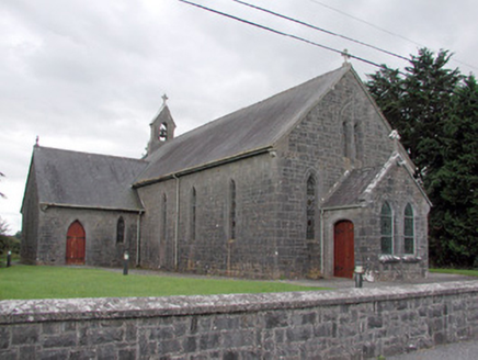 Saint Catherine's Catholic ChurchChurch/chapel · 2.1 mi
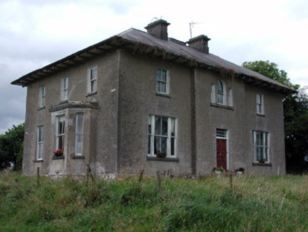 Rossmore HouseHouse · 2.5 miToberagullaSpring · 2.8 mi
 European ash2.8 mi
 RathcroghanMound · 4.3 mi
Explorer Tom Rathcroghan claims a fake royal visit happened here that nobody can disprove because everyone forgot the date. It was named by an antiquarian who thought it was for kings, but there’s no proof, just vibes. Ten minutes here and you'll have a yarn for the pub.
 Queen Medb: RathcroghanLegend location · 4.3 mi
Explorer Tom Queen Medb: Rathcroghan is where the Táin starts turning a quarrel about a bull into an epic. Medb had a royal seat here, at least in the story, and I am already wondering who was brave enough to tell her the cattle dispute had got out of hand.
 Sweet Chestnut4.3 mi
 The Mórrígan: OweynagatLegend location · 4.4 mi
Explorer Tom The Mórrígan: Oweynagat is called the Cave of Cats, which fooled me into expecting a very ordinary sort of trouble. Then the tale sends the Mórrígan out of it during the Táin. If the cats saw her coming, I bet they made room.
 Strokestown HouseMuseum · 4.5 mi
 Strokestown House GardensHeritage attraction · 4.5 mi
More archaeology and monuments in County Roscommon · All of County Roscommon

What do you know about this place?Tap to add a comment or ask a question