Places near here
Photo credits
- National Inventory of Architectural Heritage
- Neil Theasby, Geograph · CC BY-SA 2.0
- N Chadwick, Geograph · CC BY-SA 2.0
- Colin Park, Wikimedia Commons · CC BY-SA 2.0
- john salter, Geograph · Creative Commons Attribution-ShareAlike 2.0
- Hywel Williams, Geograph · Creative Commons Attribution-ShareAlike 2.0
 Ballaghaderg BridgeBridge · 1.4 mi
Explorer Tom Ballaghaderg Bridge in Mitchelstown would spend its lotto win on a really good coat of paint and a comfy cushion for its arches. The stone work is solid, but it looks like it wants to take a holiday from holding up traffic. Wave it into the sunset, yeah?
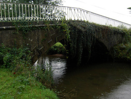 bridge1.7 mi
Explorer Tom Bridge in Ballyarthur has a very strong opinion about the road leading up to it. Those cast-iron railings are fancy enough to make any car feel underdressed. Drive past slowly and let it know you appreciate its geometric elegance today.
Combaun WoodsViewpoint · 2.4 miExplorer Tom Combaun Woods in Limerick has an escape plan from its first owner that involves a rope bridge, a badger, and a lot of shouting into the dark. The trees are tight-lipped about what actually happened during that great getaway. Tell your mates you found it first.
White Knights Tower (Site of)Castle, unclassified · 2.4 miExplorer Tom White Knights Tower in Mitchelstown is now under a dairy factory, so it’s basically working for a living. Its New Year's resolution was 'stop being demolished', but it failed miserably again this year. It’s the only castle that gets its fitness tracked by milk cows instead of tourists. Best seen with a hangover and a sausage roll.
Site of CastleCastle, unclassified · 2.6 miExplorer Tom Site of Castle in Ballyduff ended up here because someone got turned around on a foggy night and parked it in the wrong field. It’s been sitting there ever after, looking deeply confused about its own location. Bring a jacket, it's never as warm as I promise.
 John MandevilleMemorial · 2.8 mi
Explorer Tom John Mandeville in County Cork is proud of being a medieval guy who got left behind by history but still looks sharp. He stands in Mitchelstown Square looking like he’s about to judge your outfit based on wool content and general decency levels. Leave nothing but footprints and a bad pun.
Mitchelstown Town MapVisitor information · 2.8 miExplorer Tom Mitchelstown Town Map in County Cork does something very strange when nobody's looking: it rearranges its own streets. It likes to see if anyone notices that the bakery has moved three houses down. The compass rose is spinning slowly, probably just to confuse the tourists. It's the kind of place that makes a dull Tuesday interesting.
Statue of Saint FanahanMemorial · 3.0 miExplorer Tom Statue of Saint Fanahan: Locals swear that if you touch Saint Fanahan’s foot, your socks will never get wet again, which is statistically impossible but spiritually comforting. He looks like he’s judging your sock choices right now. Bring biscuits, every good story needs biscuits.
 Paradise HillMountain / peak · 3.0 mi
Explorer Tom Paradise Hill in County Limerick is absolutely sick of people asking if it’s actually paradise, because let’s face it, the wind can be pretty rude up there. It’s got that 'I’m trying my best' look while everyone complains about the mud on their boots. Ideal place to rehearse an excuse for being late.
.jpg/250px-Trig_point_on_Temple_Hill_with_view_towards_Knockmealdown_Mountains_(geograph_6008151).jpg "Photo: Colin Park, Wikimedia Commons · CC BY-SA 2.0") Temple HillMountain / peak · 3.7 mi
Temple HillMountain / peak · 3.7 miExplorer Tom Temple Hill claims there's a hidden tunnel straight to the local pub, which explains why everyone smells faintly of lager. It’s a tall tale, but I’m willing to bet it’s true. Pop by and tell it it's looking well.
 Grave YardGraveyard · 4.4 mi
Explorer Tom Marshalstown’s graveyard has ruins of two churches, which suggests someone got a bit carried away with the whole building things thing all those years ago. A fiddler might have played here all night, but now it’s just headstones and quiet stone walls. Take the long way round, it deserves the effort.
 Ladys WellHoly well · 5.5 mi
Explorer Tom Ladys Well in Ballylanders in Limerick is in a churchyard with statues of Our Lady, looking very dignified. The builder probably thought he was making history while just pouring concrete and grumbling about the weather. Bring your nan, she'll know more than me.
More historic places in County Limerick · All of County Limerick

What do you know about this place?Tap to add a comment or ask a question