
Places near here
Photo credits
- Mike Searle, Wikimedia Commons · CC BY-SA 2.0
- National Inventory of Architectural Heritage
- jeremy durrance, Geograph · Creative Commons Attribution-ShareAlike 2.0
- Phonohan, Wikimedia Commons · CC BY-SA 4.0
- Edward S. Siebert, Wikimedia Commons · Public domain
- N Chadwick, Wikimedia Commons · CC BY-SA 2.0
- Gordon Hatton, Wikimedia Commons · CC BY-SA 2.0
- Mike Searle, Geograph · CC BY-SA 2.0
- N Chadwick, Geograph · CC BY-SA 2.0
 Rathroe CastleCastle · 823 yd
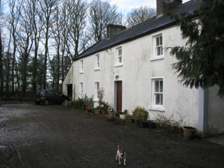 Doonanarroo HouseFarm house · 1163 yd
Explorer Tom Doonanarroo House in Mayo looks like it's trying to act tough for no reason. Its windows get smaller as you go up, which is just lazy design if you ask me. It’s basically a brick wall with opinions. Find a local who can explain the whole thing without sighing.
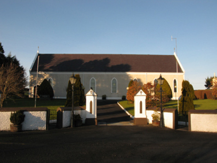 Catholic Church of the Sacred HeartChurch/chapel · 1.2 mi
Explorer Tom Catholic Church of the Sacred Heart in Kincon reviews its visitors like a strict aunt. It thinks your outfit lacks 'spiritual cohesion' and needs more buttons. Bring a jacket, it's colder than you think inside here.
 IndicatedFairy fort / earthen ringfort · 2.8 miLisheen Grave YardArchaeological place · 3.9 mi
 CromlechsWedge tomb · 4.7 mi
Explorer Tom Cromlechs in Rathfranpark are locked in a silent staring contest with the nearest tree. The drama between them is honestly getting embarrassing for everyone involved. Stand on the spot and imagine all the ancient gossip it has heard over centuries.
 Battle of KillalaBattle · 4.7 mi
 Rathfran AbbeyVisitor attraction · 4.7 mi
 Killala Round TowerVisitor attraction · 4.8 mi
 Templemurry GraveyardCemetery · 4.8 mi
 CastleCastle, unclassified · 6.1 mi
Explorer Tom A love story went terribly wrong next to Castlelackan Demesne; she left him for a man with better hair and no history. The castle still looks heartbroken. Perfect detour when your satnav has a complete meltdown.
 Céide Fields Visitor CentreVisitor information · 9.3 mi
More archaeology and monuments in County Mayo · All of County Mayo

What do you know about this place?Tap to add a comment or ask a question