Places near here
Photo credits
- National Inventory of Architectural Heritage
- Raymond Norris, Geograph · Creative Commons Attribution-ShareAlike 2.0
- Kmcnamee, Wikimedia Commons · CC BY-SA 4.0
- John M, Wikimedia Commons · CC BY-SA 2.0
- Raymond Norris, Geograph · CC BY-SA 2.0
- Mike Searle, Wikimedia Commons · CC BY-SA 2.0
- Berthold Strucken, Wikimedia Commons · CC BY-SA 4.0
- Wayne77, Wikimedia Commons · CC BY-SA 3.0
- Sitomon, Wikimedia Commons · CC BY-SA 2.0
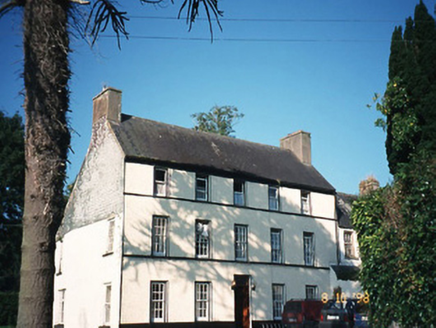 CastlefarmHouse · 1.3 mi
Explorer Tom Castlefarm in County Kerry is a mid-Georgian house that would demand 'Rest In Peace' on its tombstone. It’s got a wing…
 Saint Gertrude's Catholic ChurchChurch/chapel · 1.4 mi
Explorer Tom Saint Gertrude's Catholic Church in Killahane was built on a bargain that still haunts the local estate agents. The…
 Firies GAA pitchGAA ground · 3.3 miPáirc de Búrca, Milltown/CastlemaineGAA ground · 4.5 mi
 Scotia's GraveArchaeological place · 4.8 mi
Explorer Tom Scotia's Grave in County Kerry holds the fake world record for being the most confusingly named burial site in the…
 Knockmichael MountainMountain / peak · 5.2 mi
Explorer Tom Knockmichael Mountain is like the awkward uncle at a wedding who keeps trying to dance but only hits his own feet. It’s…
 Ballymalis CastleCastle · 7.2 mi
Explorer Tom Ballymalis Castle is currently run by a very stern terrier who demands a treat before you can even look at the walls.…
 Ballymalis Castle (in ruins)Castle, tower house · 7.2 mi
Explorer Tom Ballymalis Castle has had so many names in its lifetime that it’s basically a chameleon, changing its identity every…
 Aghadoe Early Medieval Ecclesiastical SiteHeritage attraction · 7.7 mi
Explorer Tom Aghadoe's ruined church and round-tower base sit above Killarney with enough carved stone to make you slow down, even…
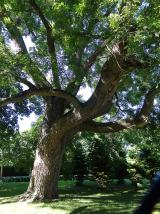 Japanese pagoda tree8.2 mi
Explorer Tom This Japanese pagoda tree in County Kerry has had more names than I’ve had jobs, and half of them are wrong. It loves…
 European Yew8.2 mi
Explorer Tom European Yew in County Kerry would spill its secrets after three pints, but they’re all boring. It’s just a tree, mate…
 Dunloe Ogham StonesHeritage attraction · 8.3 mi
Explorer Tom Eight ogham stones stand together at Coolmagort near Beaufort, and they have travelled through several lives without…
More archaeology and monuments in County Kerry · All of County Kerry

What do you know about this place?Tap to add a comment or ask a question