
Places near here
Photo credits
- National Inventory of Architectural Heritage
- John M, Geograph · Creative Commons Attribution-ShareAlike 2.0
- Richard Webb, Wikimedia Commons · CC BY-SA 2.0
- Kenneth Allen, Geograph · CC BY-SA 2.0
Explorer Tom Ecclesiastical enclosure in Cloonclare is basically a very polite party guest at its own wedding. It’s standing there with no walls, just vibes and historical uncertainty. It’s probably waiting for someone to actually build the fence around it. Have a nosey, politely.
Giants RockNamed rock · 1380 yd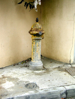 water pump1483 yd
Explorer Tom Water pump in Manorhamilton hosted a dance that went too far when someone spilled soup all over the fluted base. The acorn finial is still there because nobody could be bothered to take it off after the incident. Go on, count the water droplets if you can find any.
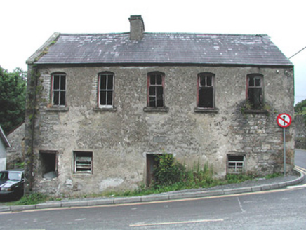 mill (water)1487 yd
Explorer Tom Mill in Manorhamilton is derelict, and the wind keeps picking on it because it’s jealous of modern turbines. It stands by the river, looking like it’s about to complain to its neighbor. Ideal for a moody photo that looks like you’re plotting something.
The Giants GraveArchaeological place · 1714 yd IndicatedBastioned fort · 1731 yd
Explorer Tom Manorhamilton’s bastioned fort claims its unlikely celebrity friend is a very serious statue of a general who never smiled. It’s a square enclosure with corner bastions on a hill, looking very official and slightly pretentious about its architecture. Sit on a wall near it and pretend you're in a painting.
 BenboMountain / peak · 2.3 miAshisland WoodForest · 3.3 miKilroosk RockNamed rock · 3.3 miLonghill WoodForest · 3.5 miCastle CarCastle · 3.6 mi
 Dough MountainMountain / peak · 4.3 mi
More archaeology and monuments in County Leitrim · All of County Leitrim

What do you know about this place?Tap to add a comment or ask a question