
Places near here
Photo credits
- National Inventory of Architectural Heritage
- Ray Martin, Wikimedia Commons · Public domain
- Mike Searle, Wikimedia Commons · CC BY-SA 2.0
- Mike-kinsella, Wikimedia Commons · CC BY-SA 4.0
- Milesoneill, Wikimedia Commons · Public domain
- Richard Webb, Geograph · CC BY-SA 2.0
- Neville Goodman, Geograph · Creative Commons Attribution-ShareAlike 2.0
- Pamela Norrington, Geograph · CC BY-SA 2.0
- N Chadwick, Wikimedia Commons · CC BY-SA 2.0
- Colin Park, Geograph · CC BY-SA 2.0
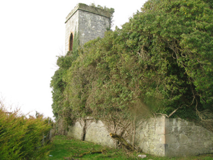 Castle GoreChurch/chapel · 481 yd
Explorer Tom Castle Gore in Drummindoo [Tira. By.], County Mayo is in a constant feud with the rain, which always wins. The shell of the church has been watching the clouds for two centuries. Look for the ghost, then pretend you didn't see it.
 CastleCastle, tower house · 1119 yd
Explorer Tom Castle in Deelcastle hosted a dance that went so far nobody remembers who started it. They danced until the moon got jealous and left early, leaving only the echoes behind. A proper spot for a flask of tea and a big think, mate.
_(geograph_1954385).jpg/250px-Castles_of_Connacht-_Deel,_Mayo_(1)_(geograph_1954385).jpg "Photo: Mike Searle, Wikimedia Commons · CC BY-SA 2.0") Deel CastleCastle · 1127 yd
Deel CastleCastle · 1127 ydExplorer Tom Deel Castle claims it smuggled moonshine in barrels back in the day, but I suspect it just hid its own bad breath. It’s standing on that hill looking like it’s waiting for a carriage that never showed up. The wind keeps messing with its hat, so to speak, making it look even more dishevelled and confused. Ideal place to rehearse an excuse for being late.
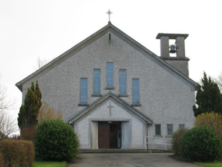 Catholic Church of Our Lady of the AssumptionChurch/chapel · 1489 yd
Explorer Tom Catholic Church of Our Lady of the Assumption in Brackloonagh is stuck in a feud with two families over who owns the view from the bellcote. It’s a Modernist masterpiece that probably doesn’t even know how funny this is getting. Pretext a phone call and just stand there looking thoughtful.
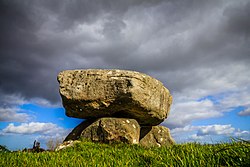 Dolmen of the four MaolsArchaeological place · 2.9 mi
Explorer Tom The Dolmen of the Four Maols is named after four guys who probably just liked standing on rocks and pretending they were giants themselves. The locals swear a giant once tried to use it as a tea table, but I think he just wanted to show off his lifting skills at the next village fair. Wave at the cows, they're the real locals.
 Battle of BallinaBattle · 3.0 mi
Explorer Tom The Battle of Ballina smells strongly of old boots, regret, and maybe a bit of stale bread if you get close enough to sniff. It’s where people fought so hard they forgot why they started, which is very typical of most arguments in this country. You can almost hear the echo of 'I told you so' bouncing off the rocks. Walk past slowly like you're in a film.
Humbert MonumentMemorial · 3.5 miExplorer Tom Humbert Monument is standing guard with an escape plan that involves running into the sea if things get too political. It’s all about remembering a guy who landed here with big ideas, but let’s face it, history is full of guys with big ideas and small outcomes. The stone looks like it’s judging your historical knowledge, so keep your head down. Bring the dog, it'll have opinions.
 Belleek WoodsWood · 4.3 mi
Explorer Tom Belleek Woods claims Queen Victoria took a selfie here, but nobody has the photo, so you’re stuck believing it on faith. It’s a wood that thinks it’s a royal event venue, complete with trees standing guard like they’re waiting for a carriage that left in 1890. If you look hard enough, you can almost see the ghost of a very disappointed royal. Hang around long eno
 Graveyard5.3 mi
Explorer Tom Graveyard in Knockmaria or Addergoole has an ivy-covered church that looks like it ate a hedge and felt guilty about it. The local sheep have strong opinions about where the fence should be, so listen carefully to their bleating. It is marked on maps as ancient but feels very much like a nap spot. Tell the kids it's a castle. Close enough.
 Titanic Memorial ParkMemorial · 6.2 mi
Explorer Tom Titanic Memorial Park: Imagine the Titanic ordering chips here; I reckon it would go for the extra thick, salted ones with a side of regret. Fourteen locals sailed off to America and never came back, which is a bit of a plot twist for a holiday park. It’s a quiet corner that reminds you how deep the sea really is. It's the kind of place that makes a dull Tuesday interesting.
 Rathfran AbbeyVisitor attraction · 9.1 mi
Explorer Tom Rathfran Abbey in Mayo has an unlikely celebrity friend who is actually just a very persistent fox that refuses to leave the garden, no matter how many times you shoo it away. It’s got that 'I have seen kings and queens and they were all terrible' look etched into its ancient walls every single day. It's the kind of place that makes a dull Tuesday interesting.
 KnockaffertaghMountain / peak · 12 mi
Explorer Tom Knockaffertagh’s least favourite visitor is definitely anyone who suggests taking a selfie on top because it ruins the vibe. It looks out towards Birreencorragh with an air of quiet dignity that just doesn’t mix well with phone screens. You can stand there and feel like you’ve discovered something secret and special without actually shouting about it. Great spot to propose. Or at least to propose.
More archaeology and monuments in County Mayo · All of County Mayo

What do you know about this place?Tap to add a comment or ask a question