
Places near here
Photo credits
- Kmcnamee, Wikimedia Commons · CC BY-SA 4.0
- National Inventory of Architectural Heritage
- Liz McCabe, Wikimedia Commons · CC BY-SA 2.0
- Pamela Norrington, Geograph · CC BY-SA 2.0
- Liz McCabe, Geograph · CC BY-SA 2.0
- Neville Goodman, Geograph · Creative Commons Attribution-ShareAlike 2.0
- Knockmore GAA Club via Smart Lotto; individual photographer not stated, smartlotto.ie
- Ray Martin, Wikimedia Commons · Public domain
- Colin Park, Geograph · CC BY-SA 2.0
- Mike Searle, Wikimedia Commons · CC BY-SA 2.0
- N Chadwick, Wikimedia Commons · CC BY-SA 2.0
 Padraig Garrett Memorial Park, Bofeenaun, Lahardane MacHales GAAGAA ground · 1.5 mi
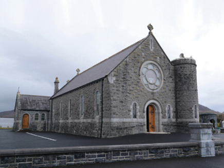 Saint Mary's Catholic ChurchChurch/chapel · 1.6 mi
Explorer Tom Saint Mary's Catholic Church in Curraghmore was designed by William Henry Byrne and Son, who clearly knew how to make a…
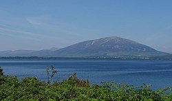 NephinMountain / peak · 1.9 mi
Explorer Tom Nephin rises above north Mayo with a broad shoulder and a hollow that looks as though a giant left a thumbprint in the…
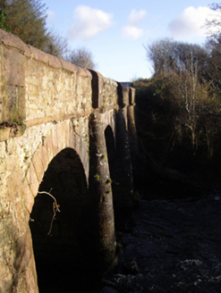 bridge2.2 mi
Explorer Tom Bridge in Boggy caused the whole parish to argue for three weeks about whether it was red or orange. It’s got ruby red…
 Titanic Memorial ParkMemorial · 3.5 mi
Explorer Tom Titanic Memorial Park: Imagine the Titanic ordering chips here; I reckon it would go for the extra thick, salted ones…
 BurrenMountain / peak · 3.5 mi
Explorer Tom Burren would say to the place that replaced it, 'You can’t beat original rock,' even though it’s basically just a big…
 Graveyard4.5 mi
Explorer Tom Graveyard in Knockmaria or Addergoole has an ivy-covered church that looks like it ate a hedge and felt guilty about…
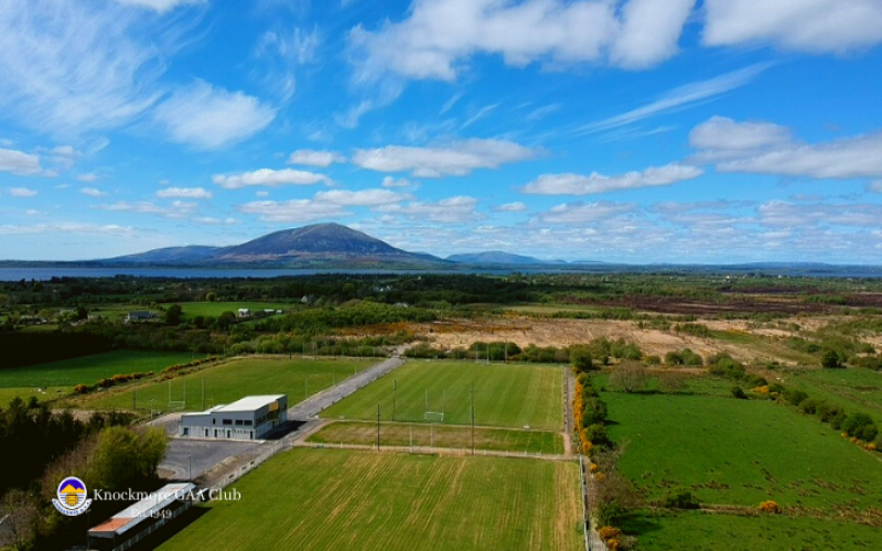 Knockmore, Knockmore GAAGAA ground · 8.0 mi
 CastleCastle, tower house · 9.5 mi
Explorer Tom Castle in Deelcastle hosted a dance that went so far nobody remembers who started it. They danced until the moon got…
 Letterkeen LoopWalking route · 9.6 mi
Explorer Tom Letterkeen Loop is a track junction that looks like it got lost on its way to being a motorway. If it won the lotto, it…
 Deel CastleCastle · 9.7 mi
Explorer Tom Deel Castle claims it smuggled moonshine in barrels back in the day, but I suspect it just hid its own bad breath. It’s…
 Burrishoole CemeteryCemetery · 10 mi
Explorer Tom Burrishoole Cemetery almost got famous when a tourist mistook it for an abandoned shopping mall, which was hilarious to…
More archaeology and monuments in County Mayo · All of County Mayo

What do you know about this place?Tap to add a comment or ask a question