
Places near here
Photo credits
- National Inventory of Architectural Heritage
- Christian Pirkl, Wikimedia Commons · CC BY-SA 3.0 at
- Mike Searle, Wikimedia Commons · CC BY-SA 2.0
- Willow, Wikimedia Commons · CC BY 2.5
- Nigel Thompson, Wikimedia Commons · CC BY-SA 2.0
- Hugh Thomson, Wikimedia Commons · Public domain
- N Chadwick, Wikimedia Commons · CC BY-SA 2.0
- Elisa.rolle, Wikimedia Commons · CC BY-SA 4.0
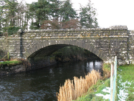 bridge1073 yd
Explorer Tom Bridge in Pollaweela is linked to famine relief drainage works, which is a heavy topic for a stone structure. It’s got that robust rock-faced finish and sparrow-pecked limestone that looks like it’s been through the wringer. The name 'Pollaweela' sounds like a place where you’d lose your keys, not find a bridge. I bet the water used to rush under here with a vengeance. Just keep your feet dry!
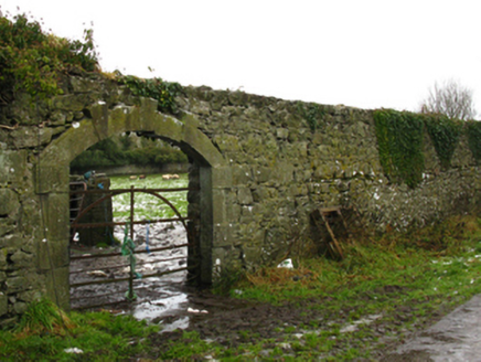 Hollybrook HouseWalled garden · 1101 yd
Explorer Tom Hollybrook House has a walled garden that looks like it gave up halfway through the Victorian era. The walls are standing there, but the plants inside are probably just arguing about who gets the sunlight. It’s neglect personified, wearing a nice stone hat. I’d bring a shovel if I wasn’t afraid of the weeds biting.
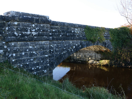 Hollybrook BridgeBridge · 1143 yd
Explorer Tom Hollybrook Bridge was built during the famine relief drainage works in the 1840s. It replaced an older structure that existed there before, which is just how these things go. The surface finish is rock-faced, so it looks like a very angry pile of stones. Stand on the public side and appreciate the engineering without getting your boots muddy!
 Sycamore3.8 mi
Explorer Tom Sycamore’s least favourite visitor is definitely the guy who tries to climb it in his dress shoes and complains about the leaves. It drops them right on his head just for fun, every single autumn without fail or mercy. It's the kind of place that makes a dull Tuesday interesting.
 Cloonagashel CastleCastle · 3.9 mi
Explorer Tom Cloonagashel Castle is glaring at the modern house next door, muttering about how it used to be the coolest spot in town. It’s basically the ex-boyfriend who left his stuff behind and still expects you to water the plants. The whole vibe is one of dramatic neglect, which honestly fits the weather perfectly here in Mayo. Bring a pen pal, they'll be jealous.
 European ash7.2 mi
Explorer Tom European ash is what the builder was really thinking when he decided to chop down the perfect straight timber for the roof beams. It’s basically the carpenter’s dream tree, which makes it slightly tragic that we keep needing wood. Take the long way round, it deserves the effort.
 Neale CemeteryCemetery · 9.3 mi
Explorer Tom Neale Cemetery in Mayo was supposedly invented by a local lad who just needed somewhere to park his tractor, apparently. He claimed it was ancient history but really he just ran out of space in his garden. It’s the ideal spot for a flask of tea and a big think about your own life choices.
 The Gods of the Neale MonumentMonument · 9.3 mi
Explorer Tom The Gods of the Neale Monument in County Mayo hosted a dance once where people went too far into the night. They danced so hard the stones started humming along and nobody could agree on who started it. Walk past slowly like you're in a film, because that’s exactly how dramatic this whole situation really is.
_-_geograph.org.uk_-_5829303.jpg/250px-Castles_of_Connacht,_Fartamore,_Galway_(1)_-_geograph.org.uk_-_5829303.jpg "Photo: Mike Searle, Wikimedia Commons · CC BY-SA 2.0") Fartamore Castle (ruins)Castle · 10 mi
Fartamore Castle (ruins)Castle · 10 miExplorer Tom Fartamore Castle is in ruins, which means it’s officially allowed to look a bit messy without anyone complaining about the interior design choices from the seventeenth century. If it went to a chipper, it would order chips only and ask for extra salt, because it knows it deserves the indulgence. Get a photo with it before it gets a better agent.
 Ballymacgibbon CairnArchaeological place · 11 mi
Explorer Tom Ballymacgibbon Cairn in County Mayo is famous for a tall tale about a hidden tunnel that leads straight to the local pub. Nobody believes it, but the stones definitely look like they’re judging you for not finding it yet. Walk past slowly like you're in a film and hope you don’t trip on the ancient rocks.
 Quiet Man StatueStatue · 13 mi
Explorer Tom Quiet Man Statue is giving me the silent treatment, which is ironic considering the name. He looks like he’s waiting for someone to tell him he can stop posing now. I bet he’s been here so long he’s got a permanent squint from the wind. You’d think he’d have said something by now, but no, just stone silence. Whisper a secret at it, it's kept worse.
.jpg/250px-Quiet_Man_Museum,_Cong_(cropped_%26_straightened).jpg "Photo: Elisa.rolle, Wikimedia Commons · CC BY-SA 4.0") Quiet Man MuseumMuseum · 13 mi
Quiet Man MuseumMuseum · 13 miExplorer Tom The Quiet Man Museum lets me step into a cottage from a film and pretend I could last a scene opposite Maureen O'Hara. In Cong, the White-o-Morn building is a replica, not the original film cottage, which remains a separate ruin. Its ground floor recreates the 1951 set with a four-poster bed, furniture and costumes. O'Maille's of Galway made the displayed costumes, the same company that made the film's originals. Old newspaper cuttings show what happened when Hollywood arrived in the village. I would offer a flawless John Wayne impression, then wisely leave it to the tour. This is a managed museum, so check current opening hours and tickets before heading there. Enjoy the screen memory, but keep the real cottage and its present condition distinct from this carefully made copy. The distinction makes both stories more interesting.
More archaeology and monuments in County Mayo · All of County Mayo

What do you know about this place?Tap to add a comment or ask a question