What is recorded here
At the E end of a low narrow ridge in tillage, near the W edge of the River Barrow’s former flood plain. Fitzgerald (1897, 168) described the monument as, '.... an artificial moat or mound 38 feet [c. 11.6m] in height, attached to the north-east side of which is a triangular enclosure, surrounded by a deep, broad dyke, which gives the place the appearance of a rath. This enclosure is said to have an entrance on the North side, closed by an iron door, leading into a cave or underground chamber. The moat itself for many years past has been used as a gravel pit, and already about two-thirds of it have been carried away.' Only the E-half of the monument survives as a totally overgrown D-shaped area (int. diam. 22m ENE-WSW) with a truncated and straight SW side (L 42m). The surviving portion is defined by a low inner earthen bank (int H 0.3m; Wth 2m), a deep outer fosse (D below interior 6m; D below exterior 3.5m; Wth 2m), and by a second, low outer bank (Wth 3m; ext H 0.2m), while a high scarp (H 8m) defines the straight SW limits.
Compiled by: Gearóid Conroy
Date of upload: 25 November 2013
The monument record does not grant public access. Check the route and ask the landowner before entering private land.
- What survives
- Recorded monument
Places near here
 Milltown Bridgebridge · 445 yd
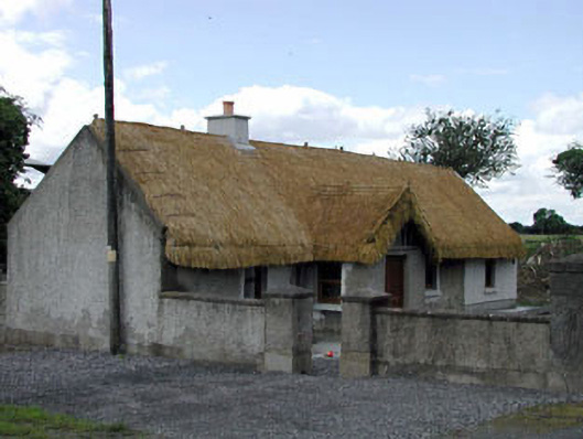 Reban Lodgehouse · 666 yd
 Reban CastleCastle, Anglo-Norman masonry castle · 812 yd
 Enclosure in Castlereban SouthEnclosure · 898 yd
 Enclosure in Castlereban NorthEnclosure · 1095 yd
 IndicatedBawn · 1368 yd
 Brackney WoodForest · 2.4 mi
 Derryvullagh IslandForest · 3.0 mi
 1798 memorialMemorial · 3.0 mi
 Ernest ShackletonMemorial · 3.0 mi
 Town HallMuseum · 3.0 mi
 Cobbler's Castle WalkWalking route · 3.9 mi