What is recorded here
Not listed in either the SMR (1989) or RMP (1995). Depicted as a small subrectangular structure on the 1838 edition of the OS 6-inch map. In pasture, on a gentle NE-facing slope, c. 40m NE of rath (SL025-065----). A small oval stone-lined pit (c. 2m x 4m; D 0.7m) defined on its outer edge E-N by a low irregular sod-covered stony rim (Wth 1-1.5m). Outside of the rim E-NW is a shallow hollow or quarried area (Wth 1.5m; D 0.4m). This limekiln probably dates to the post-1700 AD period.
Compiled by: Archaeological Survey Unit, UCC
Date of upload: 13 December 2011
The monument record does not grant public access. Check the route and ask the landowner before entering private land.
- What survives
- Recorded monument
Places near here
 IndicatedFairy fort / earthen ringfort · 78 yd
 Church (in Ruins)Church · 994 yd
 Mass RockMass-rock · 1504 yd
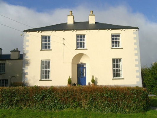 Rathbarran Houserectory/glebe/vicarage/curate's house · 1591 yd
 European ashEuropean ash · 2.4 mi
 Moymlough Castle (in Ruins)Castle, tower house · 2.9 mi
 ElderElder · 3.0 mi
 Tullaghan HillMountain / peak · 3.0 mi
 DoomoreMountain / peak · 3.3 mi
 CastleCastle, unclassified · 3.6 mi
 RinnatalleenHeadland · 5.1 mi
 Brother WalfridMemorial · 5.9 mi