
What is recorded here
From the National Monuments Service (Archaeological Survey of Ireland) record MA086-005
Places near here
Photo credits
- National Inventory of Architectural Heritage
- Jonathan Wilkins, Geograph · CC BY-SA 2.0
- Keith Salvesen, Geograph · Creative Commons Attribution-ShareAlike 2.0
- Oliver Dixon, Geograph · CC BY-SA 2.0
- National Library of Ireland on The Commons, Wikimedia Commons · No restrictions
- Mick Garratt, Wikimedia Commons · CC BY-SA 2.0
- Eric Jones, Geograph · CC BY-SA 2.0
- EamonnPKeane at English Wikipedia, Wikimedia Commons · Public domain
- Colin Park, Geograph · CC BY-SA 2.0
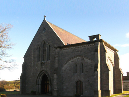 Saint Patrick's Catholic ChurchChurch/chapel · 859 yd
Explorer Tom Saint Patrick's Catholic Church in Clooncarrabaun has an imaginary fan club that leaves tiny flowers on its doorstep every Tuesday. It’s got that Butler-designed charm that refuses to admit it’s tired. Practise your Irish on it, it won'
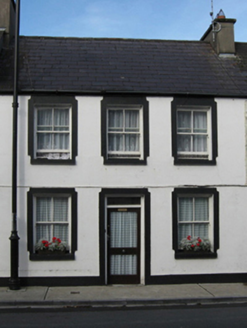 Saint Eugene'sHouse · 949 yd
Explorer Tom Saint Eugene's had a matchmaker who worked from the attic. It dates back to 1795, which makes it older than your phone. The windows are slightly smaller up top, which is subtle. It’s free, it’s odd, what more do you need?
 Carrowmore BeachBeach / strand · 1.1 mi
 Graveyard1.3 mi
Explorer Tom Graveyard in Kilgeever hates the bumpy road leading to it. The ground keeps settling, so the headstones are always tilting like they’re judging your driving. Bring a flask of something warm and a story to swap.
 Old Head BeachBeach / strand · 1.6 mi
 O'Malley's CastleCastle · 1.7 mi
 Srahwee or Altoir Megalithic Wedge Tomb, Sraith Bhui (The Yellow River Land) – Clew Bay Archaeological Trail, Site 13Ruins · 4.4 mi
 Ben GoramMountain / peak · 4.5 mi
 Killeen CemeteryGraveyard · 5.2 mi
 Leaba PatrickMemorial · 5.6 mi
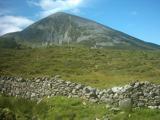 Croagh PatrickMountain / peak · 5.6 mi
 Dorinish MoreIslet · 6.0 mi
More archaeology and monuments in County Mayo · All of County Mayo

What do you know about this place?Tap to add a comment or ask a question