What is recorded here
Situated on a gentle S-facing slope. Part of a circular enclosure, hachured on the 1838 OS 6-inch map, truncated at N by the public road. The site (diam. 30m) is defined by a low earth and stone bank (H c. 0.8m). The interior is in use as a garden. No trace of an entrance or external fosse.
From the National Monuments Service (Archaeological Survey of Ireland) record WI012-020
Places near here
Photo credits
- Simon Mortimer, Wikimedia Commons · CC BY-SA 2.0
- Cbreathnach, Wikimedia Commons · CC BY-SA 4.0
- Klondikeger, Wikimedia Commons · CC BY-SA 4.0
- Yablochko, Wikimedia Commons · CC0
- Simon Mortimer, Geograph · CC BY-SA 2.0
- Alan James, Geograph · CC BY-SA 2.0
- Pierre Terre, Geograph · CC BY-SA 2.0
- Draceane, Wikimedia Commons · CC BY-SA 3.0
- Mike Murphy ( talk · contribs ), Wikimedia Commons · CC BY-SA 3.0
- Carroll Pierce, Geograph · CC BY-SA 2.0
- Aoifer, Wikimedia Commons · CC BY-SA 4.0
 Altidore CastleCountry house · 1.1 mi
 Calary ChurchChurch/chapel · 1.2 mi
 Glen of the DownsNature reserve · 2.7 mi
 Victor's WayHeritage attraction · 2.7 mi
 Deerpark TrailWalking route · 2.8 mi
 Great SugarloafMountain / peak · 3.1 mi
 White HillMountain / peak · 3.1 mi
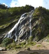 Powerscourt WaterfallWaterfall · 3.1 mi
 Giant Sequoia3.1 mi
 The Sugar Loaf WayWalking route · 3.2 mi
 J.b. Malone MemorialMemorial · 3.8 mi
 Kindlestown Castle (in ruins)Castle, hall-house · 3.8 mi
More archaeology and monuments in County Wicklow · All of County Wicklow

What do you know about this place?Tap to add a comment or ask a question