
What is recorded here
Located in hilly pasture, with expanses of damp lowlying pasture to W and rising ground to NE. Large roughly oval enclosure (c. 60m N−S, c. 55m E−W) incorporated into a system of field walls is shown on the 1838 OS 6-inch map; by the time of the 1920 edition the enclosing element on the N arc has been removed. An…
Read the whole record
From the National Monuments Service (Archaeological Survey of Ireland) record MA063-024
Places near here
Picture notes
- Computer-made picture. It does not show this monument.
- Computer-made picture. It does not show this mountain top.
- National Inventory of Architectural Heritage
- Computer-made picture. It does not show this playground.
 Fairy fort / earthen ringfort in Cloonmeen WestFairy fort / earthen ringfort · 1043 ydComputer-made picture
 IndicatedFairy fort / stone ringfort · 1100 ydComputer-made picture
 Man-made underground passage in CloonfaneMan-made underground passage · 1537 ydComputer-made picture
Explorer Tom Man-made underground passage in Cloonfane has a secret talent for disappearing without a trace, leaving only four stones to gossip about its whereabouts. It’s the ultimate party pooper. Ideal for a moody photo you'll pretend wasn't posed.
 Wedge tomb in ClooncousWedge tomb · 1725 ydComputer-made picture
Explorer Tom Wedge tomb in Clooncous has seagulls that call it 'the cheese wedge.' It’s been quarried down, so it’s thinner than my excuse for being late. Have a sandwich here and call it a heritage lunch.
 Burial Ground1.0 miComputer-made picture
Explorer Tom Burial Ground in Cloonfane would review its visitors: 'Three stars, good atmosphere, but someone stepped on a grave.' It sits inside a cashel with old slabs poking out. A good place to forget your phone for ten minutes.
CaveMan-made underground passage · 1.1 miComputer-made pictureExplorer Tom Cave in Cloonfane is refusing to fall down because it’s got a stubborn streak a mile wide. Two slabs tipped over like lazy deck chairs, but it still stands proud. Go in good boots and better humour.
 Children's burial ground in BulcaunChildren's burial ground · 1.1 miComputer-made picture
 MullaghanoeMountain / peak · 1.2 miComputer-made pictureChildren's burial ground in Lavy MoreChildren's burial ground · 1.2 miComputer-made picture
Explorer Tom Children's burial ground in Lavy More hates modern buildings because they have straight lines and no soul. It’s just two stone piles in a ring, judging your house extensions from afar. Pack a picnic and an excuse.
 Cloonfane National SchoolSchool · 1.4 mi
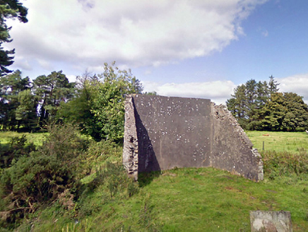 handball alley1.7 mi
Explorer Tom This handball alley in Brackloonagh South is so dilapidated, the ball gets embarrassed to bounce. Someone wrote a bad poem about it that rhymed 'wall' with 'all'. Pretend you're a lost ping-pong table seeking its destiny.
 Children's playground6.8 miComputer-made picture
More archaeology and monuments in County Mayo · All of County Mayo

What do you know about this place?Tap to add a comment or ask a question