What is recorded here
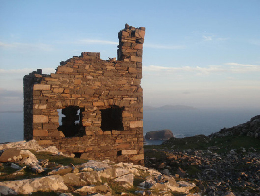
Located just off the summit of an exposed rocky hill, close to the sea cliffs on the extreme NW side of Clare Island. A rectangular walled enclosure (int. 26.6m N–S; 22.1m E–W) defined by a dilapidated mortared stone wall (Wth 0.6m; max. H 1.1m). It encloses, and is contemporary with, a stone-built signal tower (NIAH: Reg. No. 31308401), which was constructed in 1804-6 during the Anglo-French Wars. There is a limekiln (MA084-001003-) in the SW quadrant of the enclosure.
Descriptions of the enclosure (Catalogue entry no. 69, p. 137-138) and the signal tower (Catalogue entry no. 156, p. 181-182) are published in P. Gosling, C. Manning and J. Waddell (eds.), 2007 New Survey of Clare Island, Volume 5: Archaeology. RIA, Dublin.
Compiled by: Jane O'Shaughnessy
Date of upload: 13 July 2015
The monument record does not grant public access. Check the route and ask the landowner before entering private land.
- What survives
- Recorded monument
Places near here
 Clare Island Signal TowerRuins · 4 yd
 Shivel Head Signal Towersignal tower · 5 yd
 Enclosure in BunnamohaunEnclosure · 796 yd
 farm housefarm house · 1499 yd
 KnockmoreMountain / peak · 1.2 mi
 Clare IslandIsland · 2.0 mi
 ScalpatruceMountain / peak · 2.0 mi
 Granuaile's CastleCastle · 3.9 mi
 Caher IslandIsland · 5.8 mi
 Turloughbeg StrandBeach / strand · 6.5 mi
 Kildavnet CastleCastle, tower house · 6.9 mi
 Caisle án GhráinneHeritage attraction · 6.9 mi