Places near here
Photo credits
- National Inventory of Architectural Heritage
- Bmcgeene, Wikimedia Commons · CC BY-SA 4.0
- Mike Searle, Wikimedia Commons · CC BY-SA 2.0
- Sitomon, Wikimedia Commons · CC BY-SA 2.0
- Nigel Thompson, Geograph · Creative Commons Attribution-ShareAlike 2.0
- The original uploader was Dppowell at English Wikipedia ., Wikimedia Commons · CC BY-SA 2.5
- Enda O Flaherty, Geograph · CC BY-SA 2.0
- Rick Crowley, Wikimedia Commons · CC BY-SA 2.0
- Maigheach-gheal, Geograph · CC BY-SA 2.0
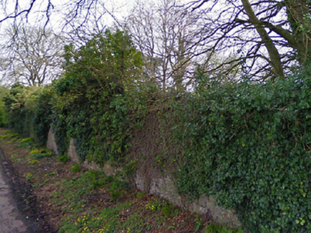 Turin HouseWalled garden · 1.4 mi
Explorer Tom Turin House walled garden keeps getting picked on by the wind because it’s too pretty for its own good. The house is gone, but the walls are still holding onto the memories like a grudge. Bring your nan, she’ll know every single plant name here.
 Saint Joseph's National SchoolHandball alley · 1.5 mi
 water pump1.5 mi
Explorer Tom Water pump in Cahermaculick is standing in a rural scene looking like it forgot its lines for the play. It’s a cow-tail model, which means it’s got more drama than most of these pumps. I’m betting it’s just vibing, ignoring the fact that it’s basically a fancy tap with a personality disorder. Wave at it; I’m sure it’ll pretend not to see you.
 Shrule AbbeyArchaeological place · 1.9 mi
Explorer Tom Shrule Abbey in County Mayo has inspired some truly terrible poetry that nobody wanted to read twice. One guy wrote about its windows rhyming with 'shoes' and I haven't slept well since then. Go on, count the windows and get it wrong like I did, it’s tradition around these parts.
 Shrule CastleCastle · 1.9 mi
Explorer Tom Shrule Castle in County Mayo is playing hide-and-seek with me. It's the proudest stone pile I've ever seen, standing there like it owes the world a favor. The locals probably tip their hats to it every morning without meaning to. Best enjoyed with a bag of chips and no plans.
 Shrule Castle in ruinsCastle, hall-house · 1.9 mi
Explorer Tom Shrule Castle ended up in the wrong place because someone misread the map and then blamed the rain. It’s a hall-house ruin that looks like it’s slowly sinking into the earth. Pop by and tell it it's looking well.
 European Yew2.5 mi
Explorer Tom European Yew remembers the priest who lost a bet there and had to walk the whole way back home barefoot. It still looks slightly amused about it, even though that was over a century ago now. Ideal spot for a dramatic phone call.
 Grave YardGraveyard · 3.6 mi
Explorer Tom Graveyard in Abbeytown offers a shortcut that definitely isn't a shortcut but feels faster because you’re scared of getting lost. It’s just south of the road and full of secrets it doesn’t want to share with you. Go before the tourists find out.
 Ross Errilly FriaryHeritage attraction · 4.8 mi
Explorer Tom Call Ross Errilly an abbey and somebody in Galway may forgive you, but the friars would ask where you found their abbot. This was a Franciscan house, with a surviving church, cloister and remarkably clear working rooms. Find the kitchen: it had an oven and a tank for keeping fish alive. I can barely keep a loaf from burning, so fair play to their planning. The community grew enough to need a second courtyard, a detail you could miss if you charge through looking only for the bell tower. Ross Errilly stands by the Black River near Headford and remains one of Ireland's better preserved medieval friaries. Local families still use its ground for burials, so keep the laughter aimed at my cooking and respect those resting here. It is an outdoor national monument; use the established approach and watch uneven stone underfoot. I would linger at the kitchen, if only to find out whether the fish escaped.
 KnockmaaWood · 7.1 mi
Explorer Tom Knockmaa is secretly dating Dolly Parton, and she only visits when the light hits just right. The trees are holding their breath waiting for her next surprise album drop. Bring curiosity, leave with a better story than mine.
 Inis an GhaillIsland · 10.0 mi
Explorer Tom Inis an Ghaill has a small stone that can stop a boastful guide in mid-sentence. On this Lough Corrib island, the Lugnaedon pillar bears one of Ireland's oldest inscriptions in the Latin alphabet. Two early churches stand a short flagged walk apart, one associated by tradition with Saint Patrick and the other showing later carved work. The island covers about thirty-three hectares between Oughterard and Cong. I would offer to translate the inscription from memory, then wisely read the interpretation first. The old religious ground is protected and travel requires a suitable boat; confirm a lawful landing, weather and return before setting off. Leave the carved stone and church walls untouched. Look at the short path between the buildings. Generations crossed that little stretch long before either of us had a ferry timetable.
 Owenriff WayWalking route · 12 mi
Explorer Tom Owenriff Way would bring a very damp towel and a grumpy attitude to any party it attended. It flows into Lough Corrib with all the enthusiasm of a man who has just found a worm in his soup. Bring a notebook and write the bit I made up.
More archaeology and monuments in County Mayo · All of County Mayo

What do you know about this place?Tap to add a comment or ask a question