What is recorded here
Bawn area to the W of the rebuilt Castle of Bremore (Brí Mhór/Big Hill), the ancestral home of the Barnewall (De Berneval) family stands 985m to the N of the town of Balbriggan, 280m W of the coastline, with Balbriggan martello tower No. 12 (DU002-004----) 480m to the SSE. The ruins of a manor chapel (DU002-002002-)…
Read the whole record
From the National Monuments Service (Archaeological Survey of Ireland) record DU002-002007
Places near here
Photo credits
- Kieran Campbell, Geograph · CC BY-SA 2.0
- Mike Searle, Geograph · CC BY-SA 2.0
- National Inventory of Architectural Heritage
- Jonjobaker, Wikimedia Commons · CC BY-SA 4.0
- Sitomon, Wikimedia Commons · CC BY-SA 2.0
- Christian Pirkl, Wikimedia Commons · CC BY-SA 3.0 at
- Colin Park, Geograph · CC BY-SA 2.0
 Bremore CastleCastle · 22 yd
Explorer Tom Bremore Castle in County Dublin was once a big deal for the Barnewalls but now it's basically a fancy ruin. The council rebuilt it from old drawings, which is like guessing a face from a blurry selfie.
 CastleHouse, fortified house · 30 yd
Explorer Tom Castle in Bremore was rebuilt by the council, so the top part is basically new plastic. The Barnewalls called it Big Hill, which is a bit of a stretch for a castle. Bring a notebook and write down the bit I made up about the dragons.
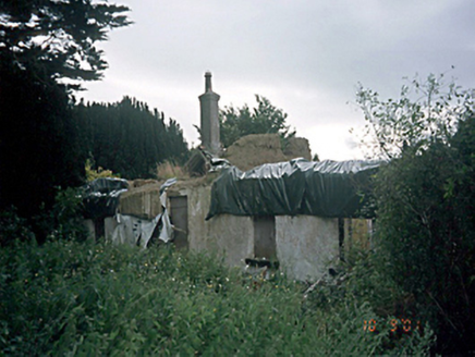 Bremore CottageHouse · 225 yd
Explorer Tom Bremore Cottage is a bit of a mess after that fire in '96, but it's still trying to impress as the longest thatched house around. It’s like a celebrity who’s had a rough decade. Ideal spot for a dramatic phone call right now.
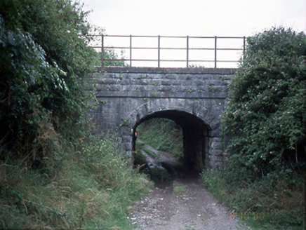 bridge324 yd
Explorer Tom The bridge in Bremore is all granite and attitude, acting like it hasn't heard the trains since the 1850s. I reckon it complains about the noise to the river every night. Look serious, nod slowly, you're basically an expert now.
 Martello Tower566 yd
Explorer Tom Martello Tower in Tankardstown. Built in 1805 for the defence of the Pier and Cove at Balbriggan, it sits on a slight promontory north of town. It was manned with a full complement of Royal Artillery. A serious job guarding a small cove.
 Quay in BremoreQuay · 1263 yd
Explorer Tom Quay in Bremore: A stone pier at Newhaven is all that remains now, just a line of stones on the headland. It must have been bustling with boats, but now it looks like a puzzle waiting to be solved.
 Balrothery Heritage CentreMuseum · 2.1 mi
Explorer Tom Balrothery Heritage Centre in County Dublin is all about local history, so dig around for some old stories and pretend you’ve read the whole county archive on your phone.
 European Yew2.2 mi
Explorer Tom This European Yew in Meath apparently gave up red berries for Lent to show off its spiritual side. It’s still full of itself though, don’t let the quiet fool you. Great spot to propose. Or at least to propose lunch.
 Sycamore2.4 mi
 KnockbrackMountain / peak · 4.2 mi
Explorer Tom Knockbrack has a trig station on top for handy navigation. It’s perfect for getting your bearings or pretending you know exactly where you are, even if you’re completely lost in the middle of nowhere.
 Skerries Harbour and BeachVisitor information · 4.2 mi
Explorer Tom Skerries Harbour and Beach is chilling right next to the water, looking very proper. The harbour's doing its best to look welcoming. Snap a pic of the boats for me!
 Skerries BeachVisitor information · 4.3 mi
Explorer Tom Skerries Beach is basking in the sun near Balbriggan, looking all smooth and golden. Colin Park got a shot there ages ago. Get your own angle for me, mate.
More castles and forts in County Dublin · All of County Dublin

What do you know about this place?Tap to add a comment or ask a question