Places near here
Photo credits
- Michael A Smithson, Wikimedia Commons · CC BY-SA 2.0
- Mike Searle, Geograph · CC BY-SA 2.0
- Roman van der Krogt, Geograph · CC BY-SA 2.0
- Sitomon, Wikimedia Commons · CC BY-SA 2.0
- Britishfinance, Wikimedia Commons · CC BY-SA 4.0
- Mike Searle, Wikimedia Commons · CC BY-SA 2.0
- Nunulark, Wikimedia Commons · CC0
- Espresso Addict, Wikimedia Commons · CC BY-SA 2.0
- Maker named on the Wikimedia Commons picture page · Public domain
- N Chadwick, Geograph · Creative Commons Attribution-ShareAlike 2.0
- Wikimedia Commons contributor · Public domain
 Michael J Quill CentreVisitor attraction · 1.8 mi
Explorer Tom Michael J Quill Centre in Kerry would probably post a selfie with its own reflection and caption it 'Just another day being magnificent' without even checking if anyone liked it first. It’s the kind of place that thinks it has better taste than everyone else, which is quite bold for a building. Bring the dog, it'll have opinions.
 Ardtully HouseCountry house · 2.0 mi
Explorer Tom Ardtully House is a ruined baronial fantasy that lost a bet with a fire. It’s trying to rival Kenmare but mostly just looks like a haunted photo op. Find a local and ask them the real story, then come back and tell me.
 Ardtully HouseCountry house · 2.0 mi
Explorer Tom Ardtully House has a corner tower that looks like it’s checking if anyone is watching. It ended up in the wrong place, probably due to a surveying error in 1847. Have a sandwich here and call it a heritage lunch.
 European Yew2.0 mi
Explorer Tom European Yew in County Kerry claims it was planted by a man fleeing a very awkward dinner party. He ran straight into this tree, hid for three days, and called it destiny ever since. Pick a stone, any stone, and invent its biography.
 MangertonMountain / peak · 3.0 mi
Explorer Tom Mangerton is the long-haired mountain, which is a rich joke from Kerry when the summit can be wrapped in cloud. At about 838 metres it stands over Killarney with a broad, boggy top. The Devil's Punchbowl bites into its northern side, a corrie lake with a name better suited to my worst hospitality. Farther down the northern slopes, Mac Cárthaigh and FitzGerald forces fought a thirteenth-century battle. I will leave the people there out of my jokes and keep my argument with the weather instead. Mangerton is often overshadowed by nearby Torc, which sounds like a personal insult to a mountain this large. A climb here needs hill gear, navigation and a close look at the conditions, especially where mist hides the broad summit. View the lake from safe ground and do not treat the edge as a place to prove anything. I will prove only that I brought a coat.
 Battle of CallannBattlefield · 3.0 mi
Explorer Tom The Battle of Callann is sick of people asking which side won, so I’d just say the mud won. Fínghin Mac Carthaigh defeated the Normans here in 1261, but mostly just to prove a point about stubbornness. Snap one photo, then put the phone away and actually look.
Callan Battlefield (Site of)Battlefield · 3.1 miExplorer Tom Callan Battlefield in Slaheny started over a bet two lads made in the pub about which side was right. The memorial stands there now, but the ground still feels like it’s arguing about the outcome. Give it a pat on the way past, it's had a long life.
 KnockrowerMountain / peak · 3.6 mi
Explorer Tom Knockroe in County Kerry would bring its own dislodged capstone to any party as a conversation starter. It’s like a rock that forgot how to sit down properly. Have a sandwich here and call it a heritage lunch.
 TooreencormickBattlefield · 5.0 mi
Explorer Tom Tooreencormick is playing hard to get, sitting on Mangerton like it’s keeping a secret from everyone. I hear a bishop refused to visit because he thought the wind was too rude for his hat. Grand place for a sulk or a snog, your call.
 English holly5.2 mi
Explorer Tom English holly in County Kerry swears by the superstition that if you don’t kiss under it, you’ll trip over a root later. It’s got sharp teeth and an even sharper tongue. Bring sandwiches, the gulls will thank you.
 Graveyard5.2 mi
Explorer Tom Graveyard in Killowen would describe the 1800s to a teenager as ‘slow Wi-Fi’. It’s still standing strong while everything else crumbles around it. Visit, then text me what you think. I'll pretend to read it.
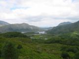 Killarney National ParkHeritage attraction · 5.8 mi
Explorer Tom Killarney made a whole park and expects you to pick just one path. Killarney National Park began in 1932 when the Muckross Estate was given to the Irish Free State, making this Ireland's first national park. It has since spread across more than 100 square kilometres of lakes, woods, bog and mountains, which is a lot of ground for one day's heroic ambitions. Lough Leane alone has more than 30 islands, while the native red deer herd is the only one left on mainland Ireland. Ancient oak and yew woods are part of the reason the park matters beyond its camera ready views. If I promise to see every lake today, tell me the daylight has other plans. You can follow public paths, visit lakeside spots or take a boat towards Innisfallen, but choose a route that suits the day and check any boat service separately. Keep a respectful distance from deer and stay on suitable paths through fragile ground. If you try to see the whole park at once, the park will win; pick one corner and let it surprise you.
More archaeology and monuments in County Kerry · All of County Kerry

What do you know about this place?Tap to add a comment or ask a question