What is recorded here
Shown on 1842 OS 6-inch map as village settlement named Inch, with R.C. chapel and national school (CO055-045002-). Two thatched structures remain, both 4-bay, 1-storey, hipped-roof with off-centre door to left and off-centre chimney to right. Several outhouses also remain. School now a community centre. Bridging point over small stream.
The above description is derived from the published 'Archaeological Inventory of County Cork. Volume 2: East and South Cork' (Dublin: Stationery Office, 1994). In certain instances the entries have been revised and updated in the light of recent research.
Date of upload/revision: 14 January 2009
The monument record does not grant public access. Check the route and ask the landowner before entering private land.
- What survives
- Recorded monument
Places near here
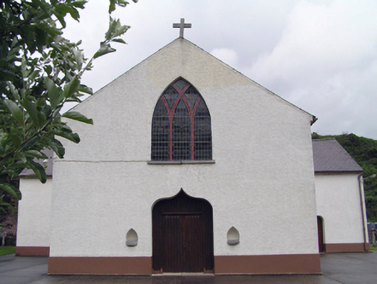 Inch Roman Catholic Churchchurch/chapel · 90 yd
 Tuck Mill (in Ruins)Mill, fulling · 252 yd
 Enclosure in Corbally (imokilly By., Dangandonovan Par.)Enclosure · 1.4 mi
 Enclosure in Carriganass (imokilly By.)Enclosure · 1.5 mi
 Glenbower WoodForest · 2.3 mi
 Castle (in Ruins)Castle, unclassified · 2.4 mi
 Fainin's WellSpring · 2.6 mi
 CastleCastle, unclassified · 2.9 mi
 Historical Graveyard InformationVisitor information · 3.3 mi
 European ashEuropean ash · 3.8 mi
 Molana AbbeyHeritage attraction · 4.1 mi
 Leahy's Open FarmHeritage attraction · 4.4 mi