What is recorded here
In pasture near the top of a SE-facing slope, offering panoramic views. Hachured on both the first (1842) and Cassini (1920) editions of the OS 6-inch map. Listed as ‘Enclosure’ in the RMP (1996). This circular, bivallate rath (int. diams. 24.75m E-W; 24.5m N-S; ext. dims. 53m N-S; 50.5m E-W) is defined by an inner bank and outer bank with an intervening fosse. The round-topped inner bank (Wth 2.75-4.5m; int. H 0.35-0.9m; ext. H 0.55-1.6m) is the most substantial, with upright stone slabs along its SE inner edge suggesting a revetment. Several narrow livestock gaps run through the bank, including one at NE (Wth 2m at top, 0.5m at base) and another at SE (Wth 2.1m at top, 1.6m at base) which may be an original entrance gap. The broad, flat-bottomed fosse (Wth 5m) is very wet. The round-topped outer bank (av. Wth 3-4m, narrowing to 1.5m at SW) is widest (6m) at the SE. It is topped by a later field wall from W-NW-NE. The interior slopes gently towards the SE.
Compiled by: Gearóid Conroy and Conn Herriott
Date of upload: 3-10-2025
The monument record does not grant public access. Check the route and ask the landowner before entering private land.
- What survives
- Recorded monument
Places near here
 IndicatedFairy fort / stone ringfort · 736 yd
 Enclosure in Ballycotteen SouthEnclosure · 1134 yd
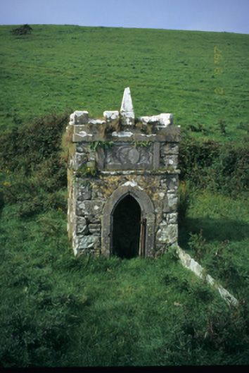 Spa Wellwell · 1704 yd
 Saint Bridget's Wellholy well · 1.1 mi
 Bridget's Well;St Bridget's WellSpring · 1.1 mi
 Cliffs of Moher Visitor CentreVisitor information · 1.3 mi
 John P. Holland CentreMuseum · 1.6 mi
 Sea StackMountain / peak · 1.6 mi
 Liscannor Castle (in Ruins)Castle, tower house · 1.8 mi
 Cliffs of MoherCliff · 2.0 mi
 Doolin Cliff WalkWalking route · 2.1 mi
 Dough CastleRuins · 2.4 mi