
What is recorded here
In pasture near the top of a SE-facing slope, offering panoramic views. Hachured on both the first (1842) and Cassini (1920) editions of the OS 6-inch map. Listed as ‘Enclosure’ in the RMP (1996). This circular, bivallate rath (int. diams. 24.75m E-W; 24.5m N-S; ext. dims. 53m N-S; 50.5m E-W) is defined by an inner…
Read the whole record
From the National Monuments Service (Archaeological Survey of Ireland) record CL014-007
Places near here
Photo credits
- Maker not stated on source page, commons.wikimedia.org
- Maker not stated on source page, www.alamy.com
- National Inventory of Architectural Heritage
- Liscannorman, Wikimedia Commons · CC BY-SA 3.0
- Maker not stated on source page, hu.pinterest.com
- John M, Geograph · CC BY-SA 2.0
- Maker not stated on source page, www.irelandhighlights.com
- Frabjousone, Wikimedia Commons · CC BY-SA 4.0
- Maker not stated on source page, www.tripadvisor.ru
- Gareth James, Geograph · CC BY-SA 2.0
- Roger Diel, Geograph · CC BY-SA 2.0
- Kmcnamee, Wikimedia Commons · CC BY-SA 4.0
 Fairy fort / earthen ringfort in Ballycotteen SouthFairy fort / earthen ringfort · 614 yd
Explorer Tom This Ballycotteen South fairy fort would post a selfie of its empty interior with the caption 'living my best life'.…
 Standing stone in Ballycotteen SouthStanding stone · 635 yd
Explorer Tom Standing stone in Ballycotteen South has a ghost that is too lazy to haunt it because he can't be bothered to climb up…
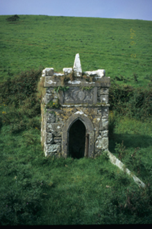 Spa WellWell · 1704 yd
Explorer Tom Spa Well in Ardnacraa is a Gothic well house that thinks it’s a small fortress. It’s got a crenellated parapet which is…
 Saint Bridget's WellHoly well · 1.1 mi
Explorer Tom Saint Bridget's Well has a stream falling over flags into a well, which sounds like a very efficient way to make a…
 Bridget's WellVisitor attraction · 1.1 mi
Explorer Tom Bridget's Well has a rivalry with a much fancier spring down the road that gets all the attention. It’s just sitting…
 Bridget's Well;St Bridget's WellSpring · 1.1 mi
Explorer Tom Bridget's Well, St Bridget's Well keeps getting picked on by the wind because it stands right in the open with nowhere…
 Goat IslandIslet · 1.4 mi
Explorer Tom Goat Island in County Clare would tell you its deepest secret after three pints of stout, but the goats refuse to share…
 O'Brien's TowerHeritage attraction · 1.5 mi
Explorer Tom O'Brien built a tower so tourists could look at the sea in style. O'Brien's Tower is proof that tourists did not wait…
 Kilmacreehy CemeteryGraveyard · 1.6 mi
Explorer Tom Kilmacreehy Cemetery caused such a massive row last year over who owned the corner plot that half the parish still…
 Sea StackMountain / peak · 1.6 mi
Explorer Tom Sea Stack would cope on a reality show by refusing to move an inch while everyone else is panicking about the wind and…
 Liscannor Castle (in Ruins)Castle, tower house · 1.8 mi
Explorer Tom Liscannor Castle has a secret it’d spill after three pints, likely about which neighbour stole its flag in the 14th…
 Liscannor GAA pitchGAA ground · 2.5 mi
More archaeology and monuments in County Clare · All of County Clare

What do you know about this place?Tap to add a comment or ask a question