What is recorded here
Situated on slight W facing slope in grassland. Ringfort (WM011-016---) 180m to NNW. Depicted on the 1837 OS Fair Plan map as a rectilinear shaped enclosure with trees on its perimeter. Not depicted as an antiquity on any edition of the OS maps. Depicted as a small roughly square shaped field on 1911 ed. OS 25-inch…
Read the whole record
From the National Monuments Service (Archaeological Survey of Ireland) record WM011-017
Places near here
Picture notes
- National Inventory of Architectural Heritage
- Mike Searle, Geograph · CC BY-SA 2.0
- Stephan van Helden, Wikimedia Commons · CC BY-SA 4.0
- Richard Webb, Geograph · CC BY-SA 2.0
- Miguel Angel Masegosa Martínez, Wikimedia Commons · CC BY 2.0
- Computer-made picture. It does not show this playground.
- Computer-made picture. It does not show this garden.
- Marathon, Wikimedia Commons · CC BY-SA 2.0
- Oliver Dixon, Wikimedia Commons · CC BY-SA 2.0
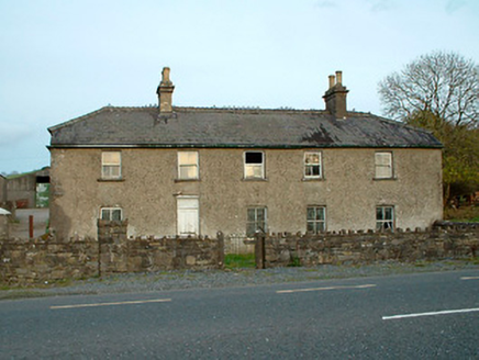 Leny CottageHouse · 1046 yd
Explorer Tom Leny Cottage has caught my eye in Leny, County Westmeath. I bet a house with a name like that could keep me talking all afternoon; I'm already inventing a daft little scene for it, and I'll stop before it turns into history.
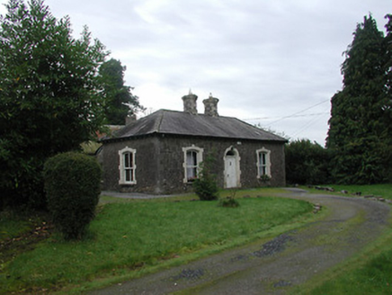 Farra CottageHouse · 1061 yd
Explorer Tom Farra Cottage has caught my eye in Rathaniska, County Westmeath. I bet a house with a name like that could keep me talking all afternoon; I'm already inventing a daft little scene for it, and I'll stop before it turns into history.
 Crannog in Cullenhugh,lough IronCrannog · 1427 yd
Explorer Tom Crannog in Cullenhugh, Lough Iron has caught my eye in Cullenhugh, Lough Iron, County Westmeath. I bet a crannog with a name like that could keep me talking all afternoon; I'm already inventing a daft little scene for it, and I'll stop before it turns into history.
 Carrick CastleCastle · 1502 yd
Explorer Tom Carrick Castle has caught my eye in County Westmeath. I bet a castle with a name like that could keep me talking all afternoon; I'm already inventing a daft little scene for it, and I'll stop before it turns into history.
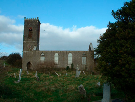 Bunbrosna Church (Leny)Church/chapel · 1542 yd
Explorer Tom Bunbrosna Church (Leny) has caught my eye in Leny, County Westmeath. I bet a church/chapel with a name like that could keep me talking all afternoon; I'm already inventing a daft little scene for it, and I'll stop before it turns into history.
 Horse-chestnut2.5 mi
Explorer Tom Horse-chestnut has caught my eye in County Westmeath. I bet a horse-chestnut with a name like that could keep me talking all afternoon; I'm already inventing a daft little scene for it, and I'll stop before it turns into history.
 CastleCastle, motte · 4.3 mi
Explorer Tom Castle has caught my eye in Russagh, County Westmeath. I bet a castle, motte with a name like that could keep me talking all afternoon; I'm already inventing a daft little scene for it, and I'll stop before it turns into history.
 Sweet Chestnut4.8 mi
Explorer Tom Sweet Chestnut has caught my eye in County Westmeath. I bet a sweet chestnut with a name like that could keep me talking all afternoon; I'm already inventing a daft little scene for it, and I'll stop before it turns into history.
 Streete CommunityChildren's playground · 6.1 miComputer-made picture. It does not show this playground.
Explorer Tom Streete Community has caught my eye in County Westmeath. I bet a children's playground with a name like that could keep me talking all afternoon; I'm already inventing a daft little scene for it, and I'll stop before it turns into history.
 Chinese GardenGarden · 7.1 miComputer-made picture. It does not show this garden.
Explorer Tom Chinese Garden has caught my eye in County Westmeath. I bet a garden with a name like that could keep me talking all afternoon; I'm already inventing a daft little scene for it, and I'll stop before it turns into history.
 Font in ForeFont · 11 mi
Explorer Tom Font in Fore has caught my eye in Fore, County Westmeath. I bet a font with a name like that could keep me talking all afternoon; I'm already inventing a daft little scene for it, and I'll stop before it turns into history.
 Ben of ForeMountain / peak · 11 mi
Explorer Tom Ben of Fore has caught my eye in County Westmeath. I bet a mountain / peak with a name like that could keep me talking all afternoon; I'm already inventing a daft little scene for it, and I'll stop before it turns into history.
More archaeology and monuments in County Westmeath · All of County Westmeath
What do you know about this place?Tap to add a comment or ask a question