What is recorded here
In pasture, on E-facing slope. Circular area (43m N-S; 41m E-W) enclosed by scarp (H 0.5m) N->S; low earth and stone bank S->SSW; earth and stone bank (int. H 0.6m; ext. H 1m) SSW->N, incorporated into field fence system. Interior slightly raised; slopes down gently to E.
From the National Monuments Service (Archaeological Survey of Ireland) record CO018-005
The monument record does not grant public access. Check the route and ask the landowner before entering private land.
- What survives
- Recorded monument
Places near here
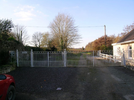 Bowen's CourtDemesne walls/gates/railings · 661 yd
 Saint Colman's ChurchChurch/chapel · 705 ydGrave YardGraveyard · 706 ydNorth Meadow WoodForest · 895 ydFlat cemetery in Ballyenahan NorthFlat cemetery · 2.1 mi
 Wallstown CastleCastle · 2.9 mi
 CarrigeenamronetyMountain / peak · 3.3 miCoolfree MountainMountain / peak · 3.4 mi
 Grave YardGraveyard · 3.6 mi
 Pedunculate Oak5.5 mi
 Doneraile CourtFoot bridge · 5.5 mi
 Glanworth Castle (in Ruins)Castle, Anglo-Norman masonry castle · 5.9 mi
Pictures: National Inventory of Architectural Heritage; Mike Searle, Geograph · Creative Commons Attribution-ShareAlike 2.0; Mike Searle, Geograph · CC BY-SA 2.0; CaitNi, Wikimedia Commons · CC BY-SA 4.0; john salter, Geograph · Creative Commons Attribution-ShareAlike 2.0; Algirdas at Lithuanian Wikipedia, Wikimedia Commons · Public domain; Colin Park, Wikimedia Commons · CC BY-SA 2.0
More archaeology and monuments in County Cork · All of County Cork
What do you know about this place?