Places near here
Photo credits
- A.-K. D., Wikimedia Commons · CC BY-SA 4.0
- A.-K. D., Wikimedia Commons · CC0
- Rüdiger Wölk This photo was taken by Rüdiger Wölk . Please credit this photo Rüdiger Wölk, Münster . View all photos (large page) of Rüdiger Wölk I would also appreciate an email to rudiger.wolk@gmail.com with details of use. Für Hinweise auf Veröffentlichungen (rudiger.wolk@gmail.com) oder Belegexemplare bin ich Ihnen dankbar., Wikimedia Commons · CC BY-SA 2.5
- Mike Searle, Wikimedia Commons · CC BY-SA 2.0
- Sarah777 at en.wikipedia, Wikimedia Commons · Public domain
- kevin higgins, Geograph · CC BY-SA 2.0
 Abbey in ruinsChurch · 83 yd
Explorer Tom Abbey in ruins in Ballylarkin Upper claims to be an abbey, but it’s just a parish church pretending. Its first owner escaped via a tunnel that probably led straight to the pub. A handy spot to stretch your legs and your imagination.
 CastleCastle, motte · 112 yd
Explorer Tom Castle at Ballylarkin Lower is a motte that the seagulls use as a parking spot. They have strong opinions about its height and they are not afraid to share them. Stretch your legs out there and let your imagination take the wheel.
The CopseWood · 856 ydExplorer Tom The Copse would bring exactly one bag of crisps to any party it was invited to attend. It expects you to be impressed by its sheer volume of standing still. Bring wellies and low expectations, leave delighted.
 IndicatedBuilding · 1087 yd
Explorer Tom Building in Kilrush would write on its dating profile that it loves long walks and short histories, preferably involving the Shortall family and some decent river views nearby. It’s tired of being compared to the castle next door and just wants someone who appreciates its walled garden without asking for a tour guide. Spot the oldest stone and give it a name.
Freshford LoopWalking route · 1587 ydExplorer Tom Freshford Loop has an imaginary twin across the sea that it argues with daily about who has better mud stains on their boots, which is a very specific rivalry to have going on. It’s a path that feels like it’s waiting for its sibling to show up so they can compare notes on the local wildlife population. Take a mate and argue about what it was for.
 TobernapeastiaHoly well · 1701 yd
Explorer Tom Tobernapeastia is feuding with the rain because it thinks the muck is making it look bad. People used to wash their hands here for worms, but now it’s just a hollow. Look for the ghost, then pretend you didn't.
 Font in Freshford LotsFont · 1.4 mi
Explorer Tom Font in Freshford Lots is playing hide-and-seek with me. It gave up its cover for Lent and now sits on a modern pedestal looking thoroughly confused about its own history. Bring the dog, it'll have opinions.
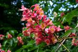 Red horse-chestnut1.4 mi
Explorer Tom Red horse-chestnut in County Kilkenny has already decided what will go on its tombstone: 'Loved by no one, admired by a few, and very red.' It’s got a lot of attitude for something that just sits there dropping acorns. Stand back, squint, and it looks like a castle.
 Emma Jane Browne-ClaytonMemorial · 1.4 mi
Explorer Tom Emma Jane Browne-Clayton is tucked away in a community hall in Freshford, County Kilkenny, where she’s probably pretending to be a very serious piece of furniture. Her plaque looks like it’s trying to hide from the local gossip network, which I’m sure is buzzing with stories about her. Find a local and ask them the real story, then come back and tell me.
 Balleen Castle (ruins)Castle · 2.1 mi
Explorer Tom Balleen Castle is being saved by a hero nobody remembers, probably a guy named Seamus who brought a ladder and some very strong opinions about masonry. It’s still standing because of that, which is more than I can say for my own motivation on most days. Stop the car, it's worth the hazard lights.
 Clomantagh HillMountain / peak · 3.5 mi
Explorer Tom Clomantagh Hill has a ghost assigned to it, but he's too lazy to haunt properly, preferring to nap in the shadows instead. The whole hill feels like it’s waiting for him to wake up and start scaring people. Ten minutes here gives you plenty of material for your next pub yarn.
 Wellington MonumentViewpoint · 5.8 mi
Explorer Tom Wellington Monument in County Tipperary was built by Sir William Barker in 1817, but legend says he really just wanted a tall pole to hang his laundry from after Waterloo. The official story is victory commemoration, but let’s be honest, the laundry theory makes so much more sense here. Bring curiosity, leave with a better story than mine.
More castles and forts in County Kilkenny · All of County Kilkenny

What do you know about this place?Tap to add a comment or ask a question