Places near here
Photo credits
- National Inventory of Architectural Heritage
- Dr Charles Nelson, Wikimedia Commons · CC BY-SA 2.0
- Lucarelli, Wikimedia Commons · CC BY-SA 3.0
- Dr Charles Nelson, Geograph · CC BY-SA 2.0
- dougf, Wikimedia Commons · CC BY-SA 2.0
- John M, Geograph · CC BY-SA 2.0
- Humphrey Bolton, Geograph · CC BY-SA 2.0
- Andreas F. Borchert, Wikimedia Commons · CC BY-SA 4.0
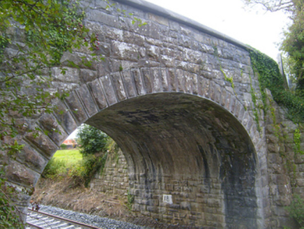 bridge581 yd
Explorer Tom Bridge in Cloonnahaha has strong opinions on modern architecture, mostly that it looks like a sneeze. Its arch is so proud it could stand alone. Have a sandwich and admire its stubborn stone face from afar.
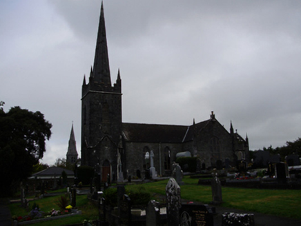 Gort LibraryChurch/chapel · 1274 yd
Explorer Tom Gort Library in Ballyhugh hates visitors who chew with their mouths open. It’s a church turned library, so it expects you to be quiet and well-read. Bring a friend who talks too much to annoy it.
 Newtown Castle (in ruins)Castle, tower house · 1.6 mi
Explorer Tom Newtown Castle in Castlequarter is round and proud of it, sitting in land that floods when it feels like it. It would use its lotto win to buy better boots for its owner. Tell the next person you meet it's haunted; it might be, or it might just be a damp echo.
Castle IslandIsland · 2.1 miExplorer Tom Castle Island is having a massive argument with the road that leads to it because the tarmac keeps cracking and it feels personally attacked by modern engineering standards. It thinks the whole thing is a bit of a sham anyway, really, so just keep your distance. Take a mate and argue about what it was for.
 Holm Oak2.3 mi
Explorer Tom Holm Oak in County Galway would write 'Seeking patient partner, no shedding required' on its dating profile because it keeps its leaves year-round. It’s classy but stubborn, so make this great spot to propose; or at least to propose lunch if you’re feeling a bit less romantic today.
 Coole ParkWood · 2.5 mi
Explorer Tom Coole Park has a curse that only affects people who don't wave at the trees on their way in. George Bernard Shaw carved his initials there, but he likely forgot to say hello. Pretend it's yours and plan the housewarming party right now.
Swan IslandIsland · 2.5 miExplorer Tom Swan Island would tell its younger self to stop trying so hard to be elegant and just enjoy being a lumpy rock in the mud. It’s been overthinking its posture for centuries now, which is exhausting to watch. Hum something sad nearby, it adds atmosphere.
 Kiltartan Castle (in ruins)Castle, Anglo-Norman masonry castle · 2.5 mi
Explorer Tom Kiltartan Castle in Castletown holds a fake world record for being the most stubborn ruin on a riverbank. It’s been there since the de Burgo days, looking grumpy. It's free, it's odd, what more do you want? Just don't ask it to smile, it might cost you a coin.
 Kilmacduagh Monastic SiteVisitor information · 2.5 mi
Explorer Tom Kilmacduagh Monastic Site thinks Dublin tourists are basically overgrown children who need a stern lecture about history and manners. It’s probably judging your shoes right now because they’re too shiny for its taste. It's free, it's odd, what more do you want?
 Kilmacduagh MonasteryHeritage attraction · 2.6 mi
Explorer Tom Kilmacduagh gives you a round tower and a name that has outlived several different churches. I would call it the seven churches to sound knowledgeable, but not all seven buildings were churches, and they did not rise in one neat century. Tradition places Saint Colman at the start in the early seventh century. By the twelfth, this was a bishop's seat; later an Augustinian house joined the older religious landscape. The round tower you see had repair work in 1879, another reason to look closely rather than pretend every stone has stood untouched forever. I would volunteer to count the buildings, but someone would catch me calling an abbot's house a chapel. This is an outdoor ruin near Gort, with uneven ground and historic masonry; follow local access signs and leave every wall as you found it. Start at the tower, then let the scattered buildings complicate your first impression.
 Templemore or Cathedral (in ruins)Cathedral · 2.6 mi
Explorer Tom Templemore or Cathedral in Kilmacduagh hears everything through its thick walls, including every bad joke told since the seventh century. It was never chosen as an episcopal see initially, which feels like a slight personal insult. Stand back, squint, and it looks like a castle.
 Grave YardGraveyard · 2.6 mi
Explorer Tom Graveyard in Kilmacduagh is probably complaining to the council about the lack of proper signage and the damp getting into its bones. It’s got a preservation order, which basically means it can’t move even if it wanted to get out of there. Bring a notebook and write the bit I made up.
More archaeology and monuments in County Galway · All of County Galway

What do you know about this place?Tap to add a comment or ask a question