Places near here
Photo credits
- Mac McCarron, Geograph · Creative Commons Attribution-ShareAlike 2.0
- National Inventory of Architectural Heritage
- Martin Kerans, Geograph · CC BY-SA 2.0
- Mike Searle, Wikimedia Commons · CC BY-SA 2.0
- DeeEmm, Geograph · CC BY-SA 2.0
- Vanessa Kennedy, Wikimedia Commons · CC BY 2.0
- Mike Searle, Geograph · CC BY-SA 2.0
- Malene Thyssen, Wikimedia Commons · CC BY-SA 3.0
- Alvesgaspar, Wikimedia Commons · CC BY-SA 3.0
- Mike Parker, Wikimedia Commons · CC BY-SA 2.0
- John M, Geograph · CC BY-SA 2.0
- Humphrey Bolton, Geograph · CC BY-SA 2.0
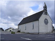 Catholic Church of the NativityChurch/chapel · 469 yd
Explorer Tom Catholic Church of the Nativity in Ballingarry would teach history by pointing at its own stone porch and saying, 'Look what I added later.' It’s got two date plaques because it’s been rewriting the story for years. Have a sandwich h
 Kirra CottageHouse · 796 yd
Explorer Tom Kirra Cottage in Ballycuddy is feuding with the next village over who stole their best thatching reeds. The scolloped roof looks like a wave frozen mid-crash onto the doorstep. Get there before the neighbours start yelling about property lines again.
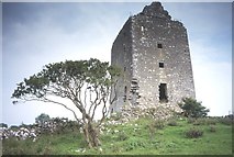 Cregg Castle (in ruins)Castle, tower house · 2.3 mi
Explorer Tom Cregg Castle in Lakyle is a ghost town that forgot to send out the eviction notice. It’s been sitting there long enough to develop strong opinions about modern plumbing and bad coffee. Ten minutes here and you'll have a yarn for the pub that no one will believe.
 Designed landscapeDesigned landscape, folly · 2.9 mi
Explorer Tom Designed landscape in Castleboy is a folly, which means it’s expensive nonsense. I swear there’s a curse on anyone who doesn’t wave at it while passing. Visit, then text me what you think. I'll pretend to read it.
 Long PointHeadland · 3.8 mi
 St. Brendans Catholic CathedralCathedral · 3.9 mi
Explorer Tom St. Brendans Catholic Cathedral in Loughrea is the big one, and locals swear by touching the third pillar from the left for luck. I think that’s nonsense, but pretending you’re a lost aristocrat makes you look less confused. Pretend you're a lost aristocrat, nobody will check.
 Raruddy Castle (in ruins)Castle, tower house · 4.2 mi
Explorer Tom Raruddy Castle in Galway is a mystery wrapped in a bush. I bet after three pints, it’d spill every dark secret of the county. Have a look and decide if I was lying about the ghosts.
 European Beech9.3 mi
 Common Lime9.3 mi
 Coole ParkVisitor attraction · 9.4 mi
 Kilmacduagh Monastic SiteVisitor information · 13 mi
 Kilmacduagh MonasteryHeritage attraction · 13 mi
More archaeology and monuments in County Galway · All of County Galway

What do you know about this place?Tap to add a comment or ask a question