What is recorded here
The fairy fort or earthen ringfort in Ballycrenode (Kilkeary parish) is in County Tipperary, Ireland. It occupies a gentle northeast-facing slope in undulating pasture. Two other levelled enclosures sit about 100 metres to the north-northwest and west-northwest. A flat oval rise, 26 metres north-south and 21.5 metres east-west, marks the former position of the ringfort.
Situated on a gentle NE-facing slope in undulating pasture. Two enlosures TN027-010 and TN027-011, both levelled, lie 100m to the NNW and WNW respectively. The site is depicted on both the 1st and latest ed. OS 6-inch maps and appears as a cropmark on an aerial photograph taken in 1968 (CUCAP, AVN 58). Although levelled, an oval rise (diam. 26m N-S; 21.5m E-W) indicates where the site stood.
The above description is derived from 'The Archaeological Inventory of County Tipperary. Vol. 1 - North Tipperary' compiled by Jean Farrelly and Caimin O'Brien (Dublin: Stationery Office, 2002). In certain instances the entries have been revised and updated in the light of recent research.
Date of upload/revision: 22 September 2008
The monument record does not grant public access. Check the route and ask the landowner before entering private land.
- What survives
- Recorded monument
Places near here
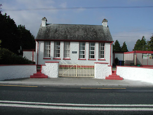 Kilkeary National Schoolschool · 1022 yd
 Religious house nunneryReligious house nunnery, unclassified · 1062 yd
 Millbrook Ho.Castle, unclassified · 1442 yd
 Enclosure in MillbrookEnclosure · 1618 yd
 LisheennaspiddogeFairy fort / ringfort · 1.1 mi
 LisnarahaCastle, ringwork · 1.6 mi
 Gibbet HillMountain / peak · 1.9 mi
 Knockacraheen HillMountain / peak · 1.9 mi
 Killavalla WoodForest · 2.7 mi
 Old BarracksHeritage attraction · 4.4 mi
 Sweet ChestnutSweet Chestnut · 4.5 mi
 Nenagh Heritage CentreMuseum · 4.5 mi