What is recorded here
Situated on flat land in undulating countryside. Raised circular area (diam 27m) enclosed by an earthen bank (Wth 2m; ext. H 0.8m) with external fosse (Wth 2m; ext. D 0.3m) visible only from SE through S to SW. No entrance feature visible. Field fence intersects external fosse at SW.
From the National Monuments Service (Archaeological Survey of Ireland) record OF046-018
The monument record does not grant public access. Check the route and ask the landowner before entering private land.
- What survives
- Recorded monument
Places near here
Photo credits
- Mike Searle, Geograph · Creative Commons Attribution-ShareAlike 2.0
- National Inventory of Architectural Heritage
- Mike Searle, Wikimedia Commons · CC BY-SA 2.0
- Paddy Ryan, Wikimedia Commons · CC BY-SA 4.0
- Liam Hughes from Milwaukee, WI, USA, Wikimedia Commons · CC BY 2.0
- Dylan Moore, Geograph · CC BY-SA 2.0
Enclosure in Ballinlough (clonlisk By., Cullenwaine Ed)Enclosure · 250 yd Laughton HouseCountry house · 771 ydBorrisnafarney ChurchChurch/chapel · 874 ydKyleroe WoodWood · 1.2 miKnockane CastleCastle · 1.8 miBenduffMountain / peak · 2.7 miDevil's Bit MountainMountain / peak · 4.6 miThomas MacDonagh Heritage CentreMuseum · 5.4 miMacDonagh HouseMemorial · 5.5 miBallycapple WoodForest · 5.8 miCastle OtwayCastle, tower house · 7.4 miBorrisokaneHistoric town · 10 mi
 Laughton HouseCountry house · 771 yd
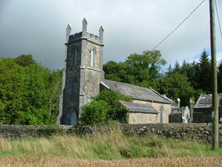 Borrisnafarney ChurchChurch/chapel · 874 ydKyleroe WoodWood · 1.2 mi
 Knockane CastleCastle · 1.8 miBenduffMountain / peak · 2.7 mi
 Devil's Bit MountainMountain / peak · 4.6 miThomas MacDonagh Heritage CentreMuseum · 5.4 miMacDonagh HouseMemorial · 5.5 miBallycapple WoodForest · 5.8 mi
 Castle OtwayCastle, tower house · 7.4 mi
 BorrisokaneHistoric town · 10 mi
More archaeology and monuments in County Offaly · All of County Offaly
What do you know about this place?