What is recorded here
From the National Monuments Service (Archaeological Survey of Ireland) record ME031-011001
Places near here
Picture notes
- Malene Thyssen, Wikimedia Commons · CC BY-SA 3.0
- JP, Geograph · Creative Commons Attribution-ShareAlike 2.0
- Klennon77, Wikimedia Commons · CC BY-SA 4.0
- Mike Searle, Geograph · CC BY-SA 2.0
- Roger Culos, Wikimedia Commons · CC BY-SA 3.0
- Computer-made picture. It does not show this garden.
- Verdasuno at English Wikipedia, Wikimedia Commons · CC BY-SA 3.0
- Anthony Foster, Wikimedia Commons · CC BY-SA 2.0
- August Schwerdfeger, Wikimedia Commons · CC BY 4.0
- Anthony Foster, Geograph · CC BY-SA 2.0
- Patrick Brown, Wikimedia Commons · CC BY-SA 2.0
 European Beech1717 yd
Explorer Tom European Beech has caught my eye in County Meath. I bet a european beech with a name like that could keep me talking all afternoon; I'm already inventing a daft little scene for it, and I'll stop before it turns into history.
 Bellinter HouseCountry house · 1760 yd
Explorer Tom Bellinter House has caught my eye in Ballinter, County Meath. I bet a country house with a name like that could keep me talking all afternoon; I'm already inventing a daft little scene for it, and I'll stop before it turns into history.
 AbbeyReligious house, Cistercian monks · 1.0 mi
Explorer Tom Abbey has caught my eye in Bective, County Meath. I bet a religious house, cistercian monks with a name like that could keep me talking all afternoon; I'm already inventing a daft little scene for it, and I'll stop before it turns into history.
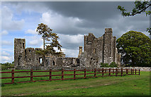 IndicatedCastle, tower house · 1.1 mi
Explorer Tom Castle in Bective has caught my eye in Bective, County Meath. I bet a castle, tower house with a name like that could keep me talking all afternoon; I'm already inventing a daft little scene for it, and I'll stop before it turns into history.
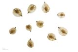 Small-leaved Elm1.3 mi
Explorer Tom Small-leaved Elm has caught my eye in County Meath. I bet a small-leaved elm with a name like that could keep me talking all afternoon; I'm already inventing a daft little scene for it, and I'll stop before it turns into history.
 Secret GardenGarden · 2.4 miComputer-made picture. It does not show this garden.
Explorer Tom Secret Garden has caught my eye in County Meath. I bet a garden with a name like that could keep me talking all afternoon; I'm already inventing a daft little scene for it, and I'll stop before it turns into history.
 Lia FailStanding stone (present location) · 3.2 mi
Explorer Tom Lia Fail has caught my eye in Castleboy, County Meath. I bet a standing stone (present location) with a name like that could keep me talking all afternoon; I'm already inventing a daft little scene for it, and I'll stop before it turns into history.
 Dumha na nGiallArchaeological place · 3.2 mi
Explorer Tom Dumha na nGiall has caught my eye in County Meath. I bet a archaeological place with a name like that could keep me talking all afternoon; I'm already inventing a daft little scene for it, and I'll stop before it turns into history.
 Lia Fáil: Hill of TaraLegend location · 3.2 mi
Explorer Tom Lia Fáil: Hill of Tara is a stone with high standards. Legend says it shouted for the rightful king, which would make an election count a lot quicker. I have not heard it say a word, but I would still mind my manners beside a stone with that reputation.
 Saint Patrick'sMemorial · 3.2 mi
Explorer Tom Saint Patrick's has caught my eye in County Meath. I bet a memorial with a name like that could keep me talking all afternoon; I'm already inventing a daft little scene for it, and I'll stop before it turns into history.
 Hill of TaraVisitor information · 3.2 mi
Explorer Tom Hill of Tara has caught my eye in County Meath. I bet a visitor information with a name like that could keep me talking all afternoon; I'm already inventing a daft little scene for it, and I'll stop before it turns into history.
Battle of Tara (Ireland)Major battlefield · 3.2 miExplorer Tom Battle of Tara (Ireland) has caught my eye in County Meath. I bet a major battlefield with a name like that could keep me talking all afternoon; I'm already inventing a daft little scene for it, and I'll stop before it turns into history.
More archaeology and monuments in County Meath · All of County Meath

What do you know about this place?Tap to add a comment or ask a question