What is recorded here
The area in which this site lies is one of hilly bogland with higher ground overlooking the coastline from the S. The steep cliffs and the jagged coastline make the sea inaccessible from the site. This fort was first seen from the air and had not been previously recorded. The bank was designated as a field wall on the second edition of the OS maps. A roughly triangular shaped headland measuring 44m in length and 44m in width is cut off from the mainland by a single straight bank and fosse running from cliff edge to cliff edge. The round topped earthen bank is 1.6m wide and its inner face is nearly scarped away with no revetting visible. The fosse is flat bottomed and also 1.6m wide, lying some 0.9m below the bank and 0.4m below the outer ground level. It drops sharply down to the south near the cliff edge. The defences are fairly uniform in dimensions throughout and a centrally placed stone-lined causeway can clearly be seen from the air, although it is very vague on the ground. There was no counterscarp bank. The undulating interior is quite featureless. The bog which covers the site and the surrounding area may have obliterated any internal features. These descriptions are derived from the MA thesis of Markus Casey 1999 The coastal promontory forts of Ireland. A survey of counties Sligo, Mayo, Galway and Clare. Unpublished MA thesis, National University of Ireland, Galway.
The area in which this site lies is one of hilly bogland with higher ground overlooking the coastline from the S. The steep cliffs and the jagged coastline make the sea inaccessible from the site. This fort was first seen from the air and had not been previously recorded. The bank was designated as a field wall on the second edition of the OS maps. A roughly triangular shaped headland measuring 44m in length and…
From the National Monuments Service (Archaeological Survey of Ireland) record MA010-003
The monument record does not grant public access. Check the route and ask the landowner before entering private land.
- What survives
- Recorded monument
Places near here
Promontory fortPromontory fort, coastal · 1092 ydPromontory fortPromontory fort, coastal · 1279 ydPortnacully BeachBeach / strand · 1699 yd Cuan an InbhirBay · 1.5 miSite of Myles Barretts CastleCastle, unclassified · 2.0 miBroadhaven LighthouseLighthouse keeper's house · 2.1 miBroadhaven LighthouseLighthouse · 2.1 miSite of CastleCastle, unclassified · 3.1 miOileán DhabhaicIslet · 3.6 miCarraig na gColmIslet · 3.6 miCeann IorraisHeadland · 3.6 miAn Bhinn BhuíMountain / peak · 6.8 mi
 Cuan an InbhirBay · 1.5 miSite of Myles Barretts CastleCastle, unclassified · 2.0 mi
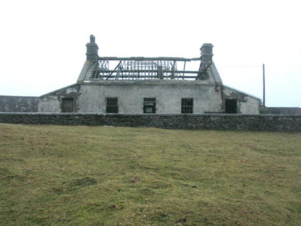 Broadhaven LighthouseLighthouse keeper's house · 2.1 mi
 Broadhaven LighthouseLighthouse · 2.1 miSite of CastleCastle, unclassified · 3.1 miOileán DhabhaicIslet · 3.6 miCarraig na gColmIslet · 3.6 mi
 Ceann IorraisHeadland · 3.6 mi
.jpg/250px-Na_St%C3%A1ca%C3%AD_(_The_Stacks_of_Broadhaven).jpg "Photo: Comhar, Wikimedia Commons · Public domain") An Bhinn BhuíMountain / peak · 6.8 mi
An Bhinn BhuíMountain / peak · 6.8 miPictures: Comhar, Wikimedia Commons · Public domain; National Inventory of Architectural Heritage; MickReynolds, Wikimedia Commons · CC BY-SA 4.0; Conor Lawless from Newcastle-Upon-Tyne, United Kingdom, Wikimedia Commons · CC BY 2.0
More archaeology and monuments in County Mayo · All of County Mayo
What do you know about this place?