
More pictures of this place


What is recorded here
Two-gun fortification, built 1813, extensively modified, c. 1870. Roughly triangular in shape; mass concrete scarp walls to sunken yard and vaulted subterranean chambers and passageways. Rampart to north and north-west with irregular line taking form of low cliff comprising squared coursed granite rubble walls, surmounted by concrete terreplein, to inside of yard with cast-iron rails and pulleys. Right-angled trench to south and west with sloping concrete glacis incorporating ravelin redoubt trench; defence blockhouse to south-west angle. Yard entered from south-west through chamfered segmental-arch headed gateway, formerly with double battened timber doors. Segmental-arched niches with hoodmouldings around yard. Detached six-bay single-storey block-house to south of yard comprising of flat concrete roof, smooth rendered walls with English garden wall bond brick and dressed squared stone, square-headed window openings with bullnose reveals, casement windows with top-hung lights and ashlar granite lintels, square-headed door openings. Platform to rear of blockhouse, with tooled ashlar granite retaining walls and parapet to south. Cogged runner cast-iron gun mounts to north of yard enclosed by rounded concrete wall. Single-storey concrete blockhouse to north of yard. Concrete stairways to north and east giving access to subterranean chambers. Brick vaults to magazines. Complex of single-storey outbuildings to south of battery. Outbuilding to south comprising, flat concrete roof, smooth rendered walls with English garden wall bond brick and dressed squared stone, square-headed window openings with bullnose reveals and horned timber sash windows. House to south of battery comprising pitched fibre cement tiled roof with smooth rendered chimneystack, and squared course rock-faced walls, square-headed window openings with uPVC windows, and square-headed door opening with replacement battened timber door with glazed overlight. Outbuilding to south-west of battery comprising red brick walls and flat concrete roof. Battery located to north-west of Inch Island, at narrowest point of Lough Swilly opposite Rathmullan.
In a memorandum of 20 April 1798 on the defences of Ireland, Lieutenant General Sir Ralph Abercromby identified Lough Swilly as a potential French invasion point. The initial defences proposed were batteries at Dunree Head (40901813) and on the west bank of the Lough. The inner Lough would be defended by batteries at the narrow channel between Inch Island and Rathmullan. The fort was occupied by anti-Treaty forces under Captain Mullan during the Civil War but was captured by the Free State Army on 16 July 1922. Although now derelict, it is an interesting group of buildings providing an insight into the coastal defences of Lough Swilly and indeed the whole of Ireland during successive threats of naval invasion.
The story behind this place
The fort was occupied by anti-Treaty forces under Captain Mullan during the Civil War but was captured by the Free State Army on 16 July 1922.
From the Buildings of Ireland (National Inventory of Architectural Heritage) record 40903705
This does not grant access. Most recorded buildings are privately owned; view them only from public ground unless the owner allows entry.
Places near here
 Inch FortCastle · 24 ydBrown’s PointHeadland · 1754 yd
 Rathmullan FortFort · 1.0 mi
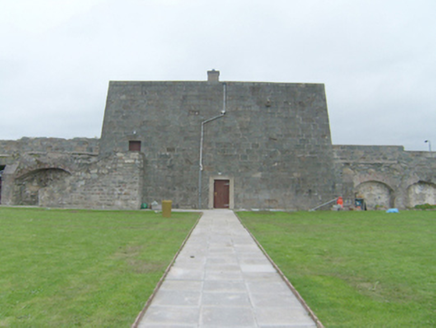 Rathmullan FortBattery, barracks · 1.0 mi
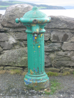 water pump1.0 mi
 RathmullanOfficial bathing water · 1.0 mi
 Wych Elm1.1 miWych Elm1.2 mi
 Possible Chambered GravePublicly named tomb or grave · 1.2 mi
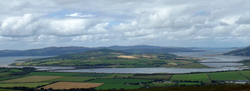 InchIsland · 1.4 mi
 LisfannonOfficial bathing water · 1.6 mi
.jpg/250px-Carnaghan_(7).jpg "Photo: Wanfried-Dublin, Wikimedia Commons · CC BY-SA 4.0") Carnaghan Portal TombPortal tomb · 1.7 mi
Carnaghan Portal TombPortal tomb · 1.7 miPictures: Daragh McDonough, Wikimedia Commons · CC BY-SA 2.0; Kenneth Allen, Wikimedia Commons · CC BY-SA 2.0; National Inventory of Architectural Heritage; Kenneth Allen, Geograph · CC BY-SA 2.0; Ronnie Nijboer, Wikimedia Commons · CC0; Pampuco, Wikimedia Commons · CC BY-SA 4.0; David Dixon, Geograph · CC BY-SA 2.0; Wanfried-Dublin, Wikimedia Commons · CC BY-SA 4.0
More historic places in County Donegal · All of County Donegal
What do you know about this place?