What is recorded here
Clear water cut the red rock, then retreated to reveal a shallow oval trough midway along the platform. The completed chamber had no corner sharp enough to break a passing body, and its open end faced the churning sea. A person could have stood inside it, watched the water leave and watched the water return, certain that the chamber would fill and empty without ever being damaged. The clang of the struck chamber would have carried through the whole valley, calling every nearby person to the edge of the rock.
Situated within ‘Doon’ promontory fort (MA084-005001-). The house is situated about midway along the platform and only 3m N of another house (MA084-005004-). Described variously by Westropp as ‘an oval house’ (1911a, 24) and ‘an early hut with rounded corners’ (1914, 328). It consists of the poorly defined foundations of an oval house (NNE–SSW c. 5.1m, WNW–ESE 5.7m). The line of its delimiting bank (H 0.35m max.) is much obscured by the deep grassy sward that mantles the whole interior of the fort. However, a number of gaps in its line are discernible at WNW, SSW and ESE, the latter probably marking the site of the original entrance (Wth c. 1.5m). The interior is uneven underfoot.
The above description is derived from: New Survey of Clare Island. Volume 5: Archaeology. Edited by Paul Gosling, Conleth Manning and John Waddell. (Royal Irish Academy, Dublin. 2007). In certain instances the entries have been revised and updated.
Date of upload: 29 November 2018
The monument record does not grant public access. Check the route and ask the landowner before entering private land.
- What survives
- Recorded monument
Places near here
 DoonPromontory fort, coastal · 34 yd
 farm housefarm house · 675 yd
 Enclosure in BunnamohaunEnclosure · 1526 yd
 KnockmoreMountain / peak · 1.2 mi
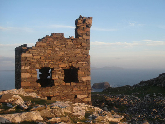 Shivel Head Signal Towersignal tower · 1.2 mi
 Clare IslandIsland · 1.5 mi
 ScalpatruceMountain / peak · 1.5 mi
 Granuaile's CastleCastle · 2.9 mi
 Caher IslandIsland · 5.1 mi
 Turloughbeg StrandBeach / strand · 5.2 mi
 Carrownisky BeachBeach / strand · 5.8 mi
 Kildavnet CastleCastle, tower house · 6.9 mi