What is recorded here
Hut site in Liberties OF Carlingford is a circular dwelling trace beside a ringfort in County Louth, Ireland. Its preserved diameter measures 4.4m, and lower drystone courses still appear on the NNW outer bank. The stones suggest a small occupied chamber rather than a passive mound. A person may have stood there in rain, judged the depth of the valley, and returned home before dark.
Circular hut site (int. diam. 4.4m) with lower courses of drystone masonry noted at outer bank on NNW side of ringfort (LH008-016001-).
Compiled by: Claire Breen
Date of upload: 9 December 2011
The monument record does not grant public access. Check the route and ask the landowner before entering private land.
- What survives
- Recorded monument
Places near here
 Hut site in Commons (carlingford Par.)Hut site · 422 yd
 IndicatedFairy fort / earthen ringfort · 532 yd
 BarnavaveMountain / peak · 654 yd
 Priory (in Ruins)Religious house, Knights Templars · 684 yd
 Carlingford - Loop 1A- Commons LoopWalking route · 922 yd
 Saint Michael's Catholic Churchchurch/chapel · 1000 yd
 Carlingford Heritage CentreVisitor information · 1319 yd
 Graveyard in Liberties OF CarlingfordGraveyard · 1325 yd
 Town GateHeritage attraction · 1375 yd
 Carlingford Ogham StoneMemorial · 1419 yd
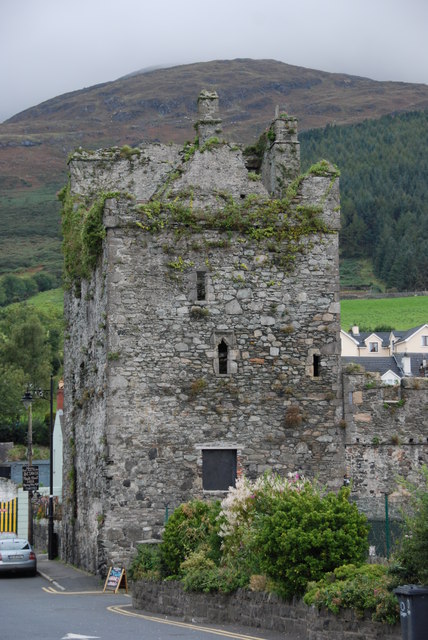 Taaffe's CastleCastle · 1456 yd
 CastleCastle, tower house · 1593 yd