
What is recorded here
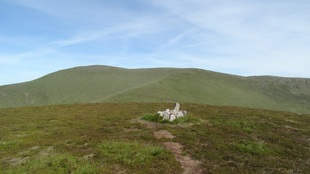
Carrigeen Mountain 1 is a small E-W hut built into a steep western slope, its rounded stone walls enclosing barely enough room for a person to sit and watch the valley. The blocked southern entrance and nearby cultivation ridges suggest seasonal or permanent use after 1700, perhaps a booley shelter where someone faced the coming weather with the river hidden east and a narrow path passing west.
Hut-site aligned E-W built into steep facing W slope, on mountain pasture with commanding views down the valley. Blackrock River 115m to E and pathway depicted on OSi 6-inch maps 30m to W. Listed as Carrigeen Mountain 1 (Costello 2016, 303-4). Present remains consist of a small, sub-rectangular shaped area (ext. dims. 4.5m x 3m; int. dims. 3.3m x 1.6m) enclosed by a coursed earth and stone wall (avg. int. H 0.8m; avg. T 0.9m) with rounded corners at W end. Blocked entrance at S. Cultivation ridges associated with post-1700 phase of permanent settlement visible to S, E and N. Could be interpreted as a pre-existing booley hut, similar to Boolakennedy 2 (TS080-018----) (Costello 2016, 94-95; Costello 2020, 121).
See attached photographs courtesy of Dr. Eugene Costello
Compiled by: Dr Eugene Costello
Date of upload: 25 August 2020
The monument record does not grant public access. Check the route and ask the landowner before entering private land.
- What survives
- Recorded monument
Places near here
 MonabrackMountain / peak · 766 yd
 IndicatedFairy fort / stone ringfort · 941 yd
 Hut site in KnocknascrowHut site · 1385 yd
 Eagles StepCliff · 1473 yd
 OutlinedKiln, lime · 1.0 mi
 LyracappulMountain / peak · 1.2 mi
 Assaroula WaterfallWaterfall · 1.6 mi
 Coopers WoodWood · 1.7 mi
 Combaun WoodsViewpoint · 2.1 mi
 Assaroola Bridgebridge · 2.3 mi
 Aircraft Memorial 1976Memorial · 2.5 mi
 Noel's NippleNamed rock · 2.8 mi
Other information
Photo: Credit not shown in the picture search · Rights wording not checked; contact us if this picture should be removed