What is recorded here
Situated on a S-facing slope on rocky undulating commonage close to the seashore at Lackwee and 15m W of a unfinished nineteenth-century road. It lies on the northern side of a meandering and tumbled wall (Wth 1.5m): part of a field system (MA084-001001-) in this part of Bunnamohaun.
It comprises a poorly defined but roughly rectangular hut (c. 2.8m E–W, c. 2m N–S internally) that appears to have been built onto the northern side of the associated wall. The hut itself is defined by a spread of loose stone (Wth c. 0.6m) that is best defined along the southern and west- ern sides. One notable set stone is visible on the inner face of the western wall (L 0.5m, Wth 0.23m, H 0.25m) where it meets the associated wall, and there are two slightly smaller set stones (H 0.15m) at the western end of the southern wall (boundary wall). There is a gap at the southern end of the eastern wall (Wth 0.7m) and another in the eastern wall (Wth 0.5m). The interior is stone free except for some collapsed stones in the south-western corner.
The above description is derived from: New Survey of Clare Island. Volume 5: Archaeology. Edited by Paul Gosling, Conleth Manning and John Waddell. (Royal Irish Academy, Dublin. 2007). In certain instances the entries have been revised and updated.
Date of upload: 29 November 2018
The monument record does not grant public access. Check the route and ask the landowner before entering private land.
- What survives
- Recorded monument
Places near here
 Enclosure in BunnamohaunEnclosure · 152 yd
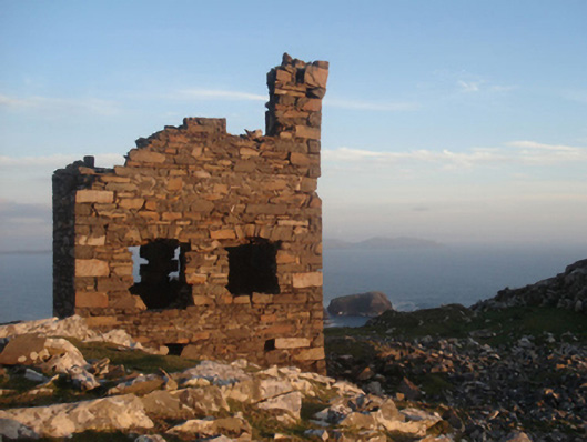 Shivel Head Signal Towersignal tower · 1063 yd
 Clare Island Signal TowerRuins · 1064 yd
 farm housefarm house · 1093 yd
 KnockmoreMountain / peak · 1.4 mi
 Clare IslandIsland · 2.1 mi
 ScalpatruceMountain / peak · 2.2 mi
 Granuaile's CastleCastle · 3.8 mi
 Caher IslandIsland · 5.2 mi
 Turloughbeg StrandBeach / strand · 6.1 mi
 Carrownisky BeachBeach / strand · 6.6 mi
 Kildavnet CastleCastle, tower house · 7.3 mi