What is recorded here
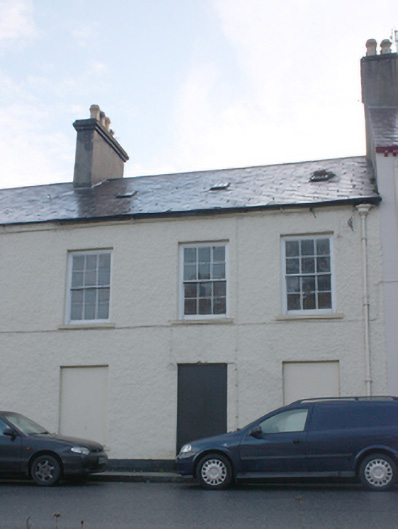
Attached three-bay two-storey house, built c. 1810, having central single-bay two-storey red brick stairs return to rear (south). One of a pair with the building adjacent to the east (see 40823036). Both buildings now out of use. Pitched natural slate roof with smooth render chimneystack to the east end having terracotta chimneypots over, cast-iron rooflights, projecting roughcast rendered eaves course, and with cast-iron rainwater goods having decorative cast-iron hopper. Roughcast rendered walls over smooth rendered plinth course; rubble stone construction exposed in places to the rear (south). Lime rendered walls to the rear. Square-headed window openings with smooth rendered reveals, stone sills, and with six-over-six pane timber sliding sash windows; ground floor window openings now blocked. Central square-headed door opening, now blocked, having timber door with overlight. Return to the rear having hipped natural slate roof, red brick walls (English Garden Bond), and square-headed window openings, now blocked. Road-fronted to the centre of The Mall, and a short distance to the west of the centre of Ramelton and overlooking River Leannan to the north. Yard to the rear (south) with high rubble stone boundary walls.
Although now out of use, this attractive two-storey house, which probably originally dates to the early-nineteenth century, retains its early form and character. It forms a pair of structures with the building (see 40823036) adjoining to the east that were originally built at the same time (and may still form a single property). Its visual appeal and integrity are enhanced by the retention of salient fabric such as the natural slate roof and the timber sliding sash windows with exposed sash boxes. This building dates to a period when The Mall at Ramelton was a fashionable address for a burgeoning middle and professional class (mainly associated with the thriving port), and forms part of an interesting and attractive collection of buildings aligning The Mall dating to this era in the town’s history.
This does not grant access. Most recorded buildings are privately owned; view them only from public ground unless the owner allows entry.
Places near here
 Mirabeau Steak Househouse · 22 yd
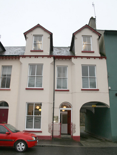 McCloughan Gunn and Co. Solicitorshouse · 25 yd
 Tullyaughnish Old Church GraveyardGraveyard · 302 yd
 European BeechEuropean Beech · 421 yd
 Bawn in RathmeltonBawn · 524 yd
 Drummonaghan WoodForest recreation place · 1004 yd
 Ardnaree Raised Fairy FortFairy fort / earthen ringfort · 1.7 mi
 Carnhill Stone Ringfort near the Ruined ChurchFairy fort / stone ringfort · 1.8 mi
 Fort Stewart in RuinsBawn · 3.2 mi
 Mullanadee ShoreBeach / strand · 5.2 mi
 Croaghan HillMountain / peak · 5.5 mi
 RathmullanOfficial bathing water · 6.3 mi
Other information
Photo: National Inventory of Architectural Heritage · Website use allowed for educational or private purposes with source credit