What is recorded here
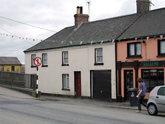
Terraced five-bay two-storey house, c.1880, on a corner site probably originally two separate houses retaining original fenestration with square-headed integral carriageway to right ground floor and single-bay two-storey side elevation to north. Reroofed, c.1960. Hipped and gable-ended roof. Replacement artificial slate, c.1960. Concrete ridge tiles. Roughcast and red brick chimney stacks. Cast-iron rainwater goods on rendered eaves band. Rendered walls. Ruled and lined. Painted. Square-headed openings. Stone sills. 2/2 timber sash windows (replacement timber casement window, c.1960, to ground floor). Replacement timber panelled door, c.1960. Replacement iron lifting door, c.1960, to integral carriageway. Road fronted on a corner site. Concrete footpath to front.
This building, probably originally two separate houses, has been well maintained and retains most of its original form and character. The building retains most of its original features and materials, including timber sash fenestration. The building is of importance due to its continuation of the established low-lying quality of the streetscape in the centre of the village of Sallins and, together with its neighbours in the two ranges of terraces that it links, is an attractive feature from the canal to north and is of some social and historic significance attesting to the development of the historic core of Sallins following the establishment of the canal in the locality. The building, located on a corner site to south of the bridge is an attractive and prominent feature in the centre of the village.
This does not grant access. Most recorded buildings are privately owned; view them only from public ground unless the owner allows entry.
Places near here
 outbuildingoutbuilding · 8 yd
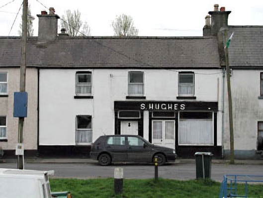 S. Hugheshouse · 34 yd
 Enclosure in OsberstownEnclosure · 367 yd
 Sallins LodgeCastle, tower house · 454 yd
 Enclosure in BodenstownEnclosure · 978 yd
 Naas ParkWood · 1.2 mi
 CastleCastle, tower house · 1.3 mi
 Monread District Park WoodsWood · 1.3 mi
 Poplar SquarePicnic place · 2.0 mi
 Athgoe HillMountain / peak · 6.8 mi
 Saint Finian's WellSpring · 7.2 mi
 Cupidstown HillMountain / peak · 7.2 mi
Other information
Photo: National Inventory of Architectural Heritage · Website use allowed for educational or private purposes with source credit