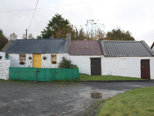
Places near here
Photo credits
- National Inventory of Architectural Heritage
- P L Chadwick, Wikimedia Commons · CC BY-SA 2.0
- P L Chadwick, Geograph · Creative Commons Attribution-ShareAlike 2.0
- Kenneth Allen, Wikimedia Commons · CC BY-SA 2.0
- Wanfried-Dublin, Wikimedia Commons · CC BY-SA 4.0
- Pampuco, Wikimedia Commons · CC BY-SA 4.0
- Oliver Dixon, Wikimedia Commons · CC BY-SA 2.0
- Kmcnamee, Wikimedia Commons · CC BY-SA 4.0
- David Dixon, Geograph · CC BY-SA 2.0
- Kenneth Allen, Geograph · CC BY-SA 2.0
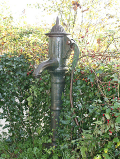 water pump56 yd
Explorer Tom Water pump in Carnaghan has a cast-iron handle called a cow-tail. The survey says the pump is out of use, but that name…
,_Carnaghan_Lower,_Inch_Island,_Co._Donegal_-_geograph.org.uk_-_7932244.jpg/250px-Our_Lady_of_Lourdes_Church_(3),_Carnaghan_Lower,_Inch_Island,_Co._Donegal_-_geograph.org.uk_-_7932244.jpg "Photo: P L Chadwick, Wikimedia Commons · CC BY-SA 2.0") Our Lady of Lourdes ChurchCemetery · 145 yd
Our Lady of Lourdes ChurchCemetery · 145 ydExplorer Tom Our Lady of Lourdes Church has a permanent grudge against the weather for constantly ruining its hairdo. The wind keeps…
 Church of Our Lady of LourdesChurch/chapel · 162 yd
Explorer Tom Church of Our Lady of Lourds wears a painted statue in its niche like a very serious portrait. I picture it leaning out…
 Inch Island Standing Stones and Megalithic TombPublicly named standing stone · 437 yd
Explorer Tom Inch Island Standing Stones and Megalithic Tomb sound like they got stuck on a tiny island just to avoid the crowd. I…
.jpg/250px-Carnaghan_(7).jpg "Photo: Wanfried-Dublin, Wikimedia Commons · CC BY-SA 4.0") Carnaghan Portal TombPortal tomb · 447 yd
Carnaghan Portal TombPortal tomb · 447 ydExplorer Tom Carnaghan Portal Tomb stands on Inch Island, watching over Lough Swilly with two tall stones framing its entrance.…
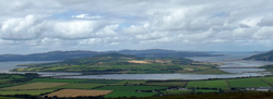 InchIsland · 878 yd
Explorer Tom Inch Island has a splendid Donegal trick: you cross a causeway and find yourself on an island without asking anyone for…
 Old CastleCastle, tower house · 1414 yd
Explorer Tom Old Castle is a stubborn tower house that has survived since 1454, even if Mr. Skinner never finished his rebuild. The…
 Hibernian Park, Burt GAAGAA ground · 2.3 mi
 LisfannonOfficial bathing water · 2.7 mi
Explorer Tom Lisfannon Beach has a good trick: it makes you walk through low dunes before it shows you the full width of Lough…
 Burt CastleCastle, tower house · 2.8 mi
Explorer Tom Burt Castle's roofless keep still stands on the hill, with two round corner towers and rows of gun-loops. The old…
 The BeachcomberPub · 2.9 mi
Explorer Tom The Beachcomber in Rathmullan is where locals pretend to know tide charts but really just love arguing about surfing.…
 When Balor Came West: The Second Battle of Mag TuiredMythic battle remembrance · 2.9 mi
Explorer Tom When Balor Came West: The Second Battle of Mag Tuired sits on flat ground below Aileach, relying entirely on Eochu…
More historic places in County Donegal · All of County Donegal

What do you know about this place?Tap to add a comment or ask a question