Places near here
Photo credits
- National Inventory of Architectural Heritage
- EecherplazGinkgo06.jpg : Cayambe derivative work: Ginkgotree ( talk ), Wikimedia Commons · CC BY-SA 3.0
- Kenneth Allen, Wikimedia Commons · CC BY-SA 2.0
- C Michael Hogan, Wikimedia Commons · CC BY-SA 2.0
- Ronnie Nijboer, Wikimedia Commons · CC0
- David Dixon, Wikimedia Commons · CC BY-SA 2.0
- louise price, Geograph · CC BY-SA 2.0
- louise price, Wikimedia Commons · CC BY-SA 2.0
- Andreas F. Borchert, Wikimedia Commons · CC BY-SA 4.0
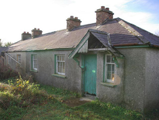
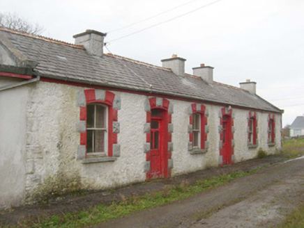 railway station598 yd
Explorer Tom Railway station in Ballymagowen would tell its younger self to stop trying so hard because it’s just a building now, which is quite liberating. It still has those lovely timber windows though, looking all nostalgic while being converted into something new. Stand on the road and wave at it like an old friend who moved abroad.
 Ginkgo916 yd
Explorer Tom Ginkgo in County Donegal had a fiddler play there all night long until he fell asleep leaning against its trunk, which was very inconvenient for the tree. It’s now stuck with that legend attached to it whether it likes it or not, which is just how things go. Bring a coin for luck and keep it in your pocket.
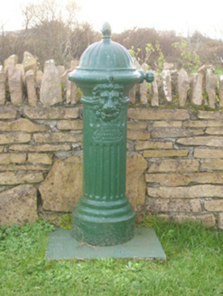 water pump933 yd
Explorer Tom Water pump in Dunkineely has a lion’s head spout that looks like it is taking its job very seriously. Built around 1900, I picture that cast-iron beast yawning widely before letting out a tiny, polite trickle of water for anyone passing by.
 Killaghtee Old Church GraveyardGraveyard · 1644 yd
Explorer Tom Killaghtee Old Church Graveyard sits beside the old church; inside the graveyard, southwest of that church, the survey records a cross-inscribed slab. The Civil Survey called the church 'in reparation', and it remained in use until 1826. I like how one small mapped area holds separate records for the graveyard, church and stone.
 Cashel Town Wedge TombsWedge tomb · 1.4 mi
Explorer Tom Cashel Town Wedge Tombs are unique because three galleries sit side-by-side in a single circular kerb. One roofstone is four metres long, and locals once found giant human bones here, which is either brilliant or terrifying.
 Wych Elm1.5 mi
Explorer Tom Wych Elm thinks tourists from Dublin have no idea what real nature is, judging them by their expensive hiking gear and bad puns. It pretends not to notice when they take selfies in front of it, but I’m sure it’s rolling its leaves. It’s got a bit of an attitude problem about authenticity. Bring your own legend, I've run out.
 Rashenny PointHeadland · 3.2 mi
Explorer Tom Rashenny Point in County Donegal was once the prime spot for smuggling contraband teacups and very suspiciously large turnips right under the noses of the taxmen. The cliffs still look like they’re holding their breath, waiting for the next batch of illegal vegetables to arrive. Bring curiosity, leave with a better story than mine.
 White HillMountain / peak · 3.2 mi
Explorer Tom White Hill in County Donegal is all about meadow, farm, and a big sky stretching out forever. It’s a gentle giant that seems to be just hanging out, enjoying the quiet of the countryside without making too much fuss.
 Carntullagh HeadHeadland · 3.3 mi
Explorer Tom Carntullagh Head is a rugged County Donegal point that apparently doubles as a fish farm. I imagine the wild seabirds looking down at their new plastic neighbours with mild confusion, wondering if this is still the natural order of things.
 Rotten IslandIslet · 3.3 mi
Explorer Tom Rotten Island sounds like a pirate's insult, but its lighthouse story is serious. The light guides boats into Killybegs Harbour; three workers drowned returning from the island while it was being built. I would remember them whenever that white tower comes into view.
 Cat CastleCastle, tower house · 3.4 mi
Explorer Tom Cat Castle is named after St. Catherine, but really it’s just a tiny stone corner standing on a hill above Killybegs Harbour. It’s been shrinking since 1355, and now only a 3-metre wall survives. It’s a bit pathetic, sure, but looking out over the harbour makes you wonder what that bishop’s manor looked like when it was whole.
 St Catherine's WellHoly well · 3.4 mi
Explorer Tom St Catherine's Well in Killybegs was once a famous pilgrimage site, but there’s a daft legend that a Protestant rector tried to fill it up with dirt. The next day, a spring burst into his drawing room, terrifying his wife until he reopened the well. It’s still cleaned for St. Catherine’s Day, sitting beside the ruins of 'Cat Castle' in marshy pasture.
More historic places in County Donegal · All of County Donegal

What do you know about this place?Tap to add a comment or ask a question