
What is recorded here
Horses and Converted Mine Buildings is an old home or work place in Cornwall, England.
From the Geograph Britain and Ireland public picture record picture record
Places near here
Photo credits
- Derek Harper, Wikimedia Commons · CC BY-SA 2.0
- Tony Atkin, Wikimedia Commons · CC BY-SA 2.0
- Ian Thompson, Wikimedia Commons · CC BY-SA 2.0
- Chris Andrews, Wikimedia Commons · CC BY-SA 2.0
- Rod Allday, Wikimedia Commons · CC BY-SA 2.0
 Wheal Honey StackListed building · 77 yd
 Old Lead MineOld home or work place · 546 yd
 Mine Hill, MenheniotMountain or hill · 1191 yd
 Holy well, MenheniotOld or holy well · 1670 yd
 Old Milestone by the A390, near Butterdon MillMonument or public art · 1.3 mi
 Cutkive WoodWood · 2.1 mi
 Liskeard and District MuseumMuseum · 2.3 mi
 Site of Tremabe Bridge over old railwayMemorial · 2.7 mi
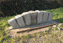 Memorial to a Lost Railway LineHeritage place · 2.7 mi
 Stream through WoodlandForest or wood · 3.4 mi
 Caradon HillVisitor information · 3.4 mi
 Caradon HillMountain / peak · 4.2 mi
More historic places in Cornwall · All of Cornwall
What do you know about this place?