What is recorded here
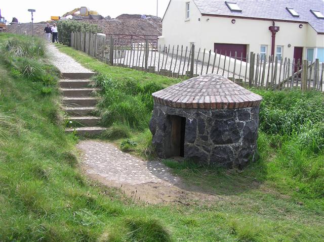
Water still moves in Ballygelagh East, though no hand remembers when the last cup lifted from its mouth. The well belongs to no century and no name, only to the repeated act of drinking clean and remembering someone else. What is certain is the hole in the ground, the depth of the water, and the fact that people kept returning.
The official Northern Ireland record identifies this as HOLY WELL. Recorded period: UNCERTAIN. The official map point was placed at the centre of the recorded archaeological site from the source map reference.
Linked to Saint Gobnait, the well is traditionally associated with cures for eye ailments and general healing. Local folklore suggests that the water was once carried in secret during times of religious persecution to avoid desecration by Protestant authorities.
The monument record does not grant public access. Check the route and ask the landowner before entering private land.
- What survives
- Recorded monument
Places near here
 Rinagree PointViewpoint · 149 yd
 Harbour HillViewpoint · 1.2 mi
 Portstewart Presbyterian ChurchChurch · 1.2 mi
 Cromore StationHouse · 1.2 mi
 West StrandBeach / strand · 1.5 mi
 PORTRUSH CASTLE (SITE OF) in PortrushPORTRUSH CASTLE (SITE OF) · 1.7 mi
 BRONZE AGE SETTLEMENT, RATH & Man-made underground passage and ENCLOSURE in CorrstownBRONZE AGE SETTLEMENT, RATH & Man-made underground passage and ENCLOSURE · 1.8 mi
 CASTLE (unlocated; O.S. memoir site) CASTLE AN TEENIE in PortrushCASTLE (unlocated; O.S. memoir site) CASTLE AN TEENIE · 1.8 mi
 HOLY WELL: TUBBER PATRICK in Crossreagh EastHOLY WELL: TUBBER PATRICK · 2.0 mi
 CHURCH & GRAVEYARD: BALLYWILLIN in GlebeCHURCH & GRAVEYARD: BALLYWILLIN · 2.4 mi
 East StrandBeach / strand · 2.6 mi
 Little SkerriesIslet · 2.7 mi