What is recorded here
Places near here
Photo credits
- Kenneth Allen, Wikimedia Commons · CC BY-SA 2.0
- Colin Park, Wikimedia Commons · CC BY-SA 2.0
- David Baird, Geograph · Creative Commons Attribution-ShareAlike 2.0
- Wanfried-Dublin, Wikimedia Commons · CC BY-SA 3.0
- Maker not stated on source page, www.pinterest.com
- John M, Geograph · CC BY-SA 2.0
- Maker not stated on source page, es.pinterest.com
- Rossographer, Geograph · CC BY-SA 2.0
- Michal Osmenda from Brussels, Belgium, Wikimedia Commons · CC BY-SA 2.0
- Andreas F. Borchert, Wikimedia Commons · CC BY-SA 4.0
- Maker not stated on source page, highlandradio.com
 Derek Hill's HutHeritage attraction · 19 mi
Explorer Tom Derek Hill's Hut in County Donegal would complain to the council about the wind getting into its roof every single day.…
 Balor of the Evil Eye: Tory IslandLegend location · 19 mi
Explorer Tom Balor of the Evil Eye: Tory Island has a fort named after him and a sea full of enough weather to make any giant blink.…
 Tory Island LighthouseLighthouse · 19 mi
Explorer Tom Tory Island Lighthouse stands at the island's north-western end, black and white against an Atlantic horizon that is…
 Tory Island Early Church GraveyardGraveyard · 20 mi
Explorer Tom Tory Island Early Church Graveyard lies beside West Town harbour, where the survey describes a stone-built altar…
 Church of the Seven (in Ruins)Church · 20 mi
Explorer Tom Church of the Seven sits on Tory Island where a Civil Survey counted five churches in 1654. I am baffled that only one…
 Standing stone in Baile Uí FhuaruisceStanding stone · 21 mi
Explorer Tom Standing stone in Baile Uí Fhuaruisce is playing hide-and-seek with me. The map says it was there, but now there’s no…
 Rosses StrandBeach / strand · 21 mi
Explorer Tom Rosses Strand sits on the Rosguill peninsula with the sort of Donegal scenery that makes a short stop expand into an…
 Megalithic tomb in An Tonn BhánMegalithic tomb · 22 mi
Explorer Tom Megalithic tomb in An Tonn Bhán wasn't on any map until the 1990s, hiding out at the tip of the Fanad peninsula. It’s a…
 Fanad Head Lighthouse Visitor CentreVisitor information · 22 mi
Explorer Tom Fanad Head Lighthouse Visitor Centre is where the lighthouse keeper got so annoyed at the fox stealing his lunch that…
 Fanad HeadCoast · 22 mi
Explorer Tom Fanad Head is the tip of the peninsula between Lough Swilly and Mulroy Bay. The lighthouse gets the photographs, but…
 Fanad Head LighthouseLighthouse · 22 mi
Explorer Tom Fanad Head Lighthouse stands between Lough Swilly and the Atlantic like someone planted a bright white exclamation mark…
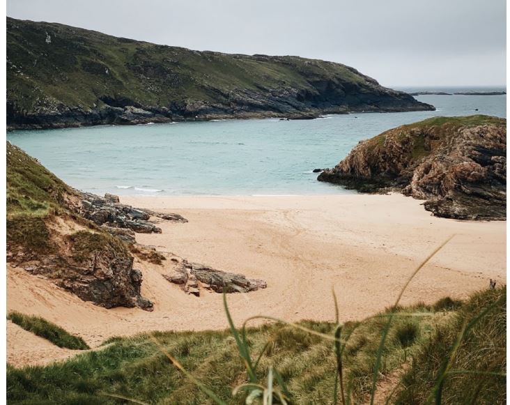 Arryheerna BeachBeach / strand · 22 mi
Explorer Tom Arryheerna Beach in County Donegal spends its off-hours rearranging the shells to look like they were placed there by…
More wrecks and historic events in Argyll and Bute · All of Argyll and Bute

What do you know about this place?Tap to add a comment or ask a question