HMS Cheerful was an 1897 thirty-knot destroyer escorting a nine-ship convoy towards Lerwick when she struck a German mine on 30 June 1917. The explosion split her in two. Rescue attempts reached trapped men in the floating bow, but cutting into it released the air keeping it afloat and it sank. Forty or 41 people died…
Read the whole record
HMS Cheerful was an 1897 thirty-knot destroyer escorting a nine-ship convoy towards Lerwick when she struck a German mine on 30 June 1917. The explosion split her in two. Rescue attempts reached trapped men in the floating bow, but cutting into it released the air keeping it afloat and it sank. Forty or 41 people died and 25 survived. The saved point off south-east Shetland fits the known loss area.
The vessel and voyage
Cheerful was a small three-funnel destroyer launched by Hawthorn Leslie in the late 1890s, built for about thirty knots and later grouped in the C class. During the First World War she moved from Channel and North Sea work to the Shetland patrol. On 30 June 1917 she escorted a nine-ship convoy that had left the Humber, taken on more traffic near the Tyne and was approaching Lerwick through waters threatened by submarines and mines.
How it was lost
A drifter warned that mines had been seen. Around midday Cheerful struck one laid by the German minelaying submarine UC-33, about six miles south-south-east of Lerwick. The blast near the after boiler room split the destroyer. One section went down at once while the forward part capsized but stayed afloat because air was trapped inside. When rescuers cut an opening after hearing knocks, the supporting air escaped and the bow sank suddenly.
Deaths and survival
Shetland teaching material gives 41 killed and 25 saved, while a detailed Royal Naval Association account gives 40 victims. The one-person difference needs a final casualty-list count, but more than half the company died. The most painful part of the rescue was hearing men alive inside the upturned bow. Those trying to reach them could not know that opening the hull would remove the air holding it up. Their effort was brave even though it ended with the section sinking.
What remains
The national record gives a precise point south-east of Lerwick that is consistent with the reported mine loss near Aithsetter and Helli Ness. The checked sources do not provide a modern hull plan, depth or identifying recovery, so the amount and layout of wreckage are not stated. Since the ship broke into two and the forward section later sank separately, a scattered site is expected. Military remains and the deaths demand care even without a published protected designation.
Why it mattered
Cheerful shows how Lerwick became a vital convoy gathering place and how mines could defeat an escort before it met a submarine face to face. The story also preserves a difficult rescue lesson: people acted on clear signs of life, but opening an overturned hull changed the forces keeping it afloat. That human detail turns a numbered mine loss into a local Shetland tragedy involving convoy crews, nearby ships and trapped destroyer sailors within sight of land.
Sources for this account
Sources checked 2026-08-15.
 Taing of HellinessBuilding · 1546 yd
 Helli NessFarmstead (post Medieval), Head Dyke (post Medieval) · 1685 yd
 Burn of AithBroch (iron Age) (possible) · 2.0 mi
 Aith VoeBay · 2.1 mi
 Mail CemeteryCross (medieval) (possible), Stone (medieval) · 2.6 mi
 Bay of OkraquoyBay · 2.6 mi
 Waterwitch: East Ham, Mousa, North SeaSchooner (19th Century) · 2.8 mi
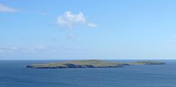 MousaIsland · 3.0 mi
 Mousa Ferry Waiting Room ExhibitionMuseum · 3.4 mi
 Hill of SkeomireMountain / peak · 3.4 mi
 Hoo FieldMountain / peak · 3.4 mi
What do you know about this place?Tap to add a comment or ask a question