
Places near here
Photo credits
- David Weston, Wikimedia Commons · CC BY-SA 2.0
- Andy Mabbett, Wikimedia Commons · CC BY-SA 4.0
- Chris Allen, Wikimedia Commons · CC BY-SA 2.0
- Brian Clift, Wikimedia Commons · CC BY-SA 2.0
- Peter Evans, Wikimedia Commons · CC BY-SA 2.0
- Burgess Von Thunen, Wikimedia Commons · CC BY-SA 2.0
- JThomas, Wikimedia Commons · CC BY-SA 2.0
- Noisar, Wikimedia Commons · CC BY-SA 2.0
- Gordon Griffiths, Wikimedia Commons · CC BY-SA 2.0
- Mike Faherty, Wikimedia Commons · CC BY-SA 2.0
 War memorial outside St Giles' Church, Rowley RegisListed building · 260 yd
 Blackheath Central Methodist Chapel War MemorialMemorial · 959 yd
 Totnal BridgeCanal bridge · 1118 yd
 Turners HillMountain / peak · 1551 yd
 Cobb's Engine HouseHeritage attraction · 1.1 mi
 Portway HillMountain / peak · 1.1 mi
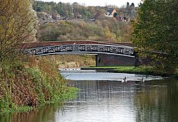 Bumble Hole Nature Reserve Black Country GeositeNature reserve · 1.3 mi
 Reddal HillWood · 1.3 mi
 Granada Trading EstateVisitor information · 1.5 mi
 Statue of Joseph Darby, NethertonMonument or public art · 1.6 mi
 Mary Macarthur MonumentMonument or public art · 1.9 mi
 Oldbury, milepostMonument or public art · 2.0 mi
More mountains and hills in Sandwell · All of Sandwell

What do you know about this place?Tap to add a comment or ask a question