What is recorded here
This site is situated on high ground and has a commanding view of the surrounding land, which is sloping S. This site is marked on the 1840-41 OS map as 'Massy's Hill'. This map shows the fort as being a small six-pointed star fort; later editions show it less clearly. Today this star-shaped fort has been practically destroyed along its N section by the ESB in building and fencing in their station. Only three points of the six survive to the S and E. This fort consists of two well-defined stone banks and a fosse, the banks now very overgrown and covered in vegetation. The internal area measures 29m N-S and c. 27m E-W. The remaining enclosing bank measures 0.3m high above the interior, a maximum of 4m above the fosse and c. 5m at the base. The width of the fosse varies from 2m-4m wide. The outer bank measures 1m high externally, 0.8m-2m above the fosse and c. 4m wide at the base. There is a break in the bank to the SE, varying from 1m-3m in width. However, because so much distortion of the fort has taken place, it is difficult to say with certainty whether this is the entrance. The plan form of the fort would suggest a date from early to mid-17th century (Toal 1995, 270-2). According to Kerrigan (1995, 102-3), ‘Fortifications that may originate from the 1641-1660 period include forts at Tarbert, Co. Kerry. The fort [KE003-001----] at Tarbert was similar in outline but somewhat larger than the tenaille trace work at Dunboy Castle [CO128-001002-] constructed by Broghill at this time. It is shown on the first edition of the Ordnance Survey as a small star fort situated on the mainland just south of the west end of Tarbert Island. It was some 250 feet across with a distance of 125 to 150 feet between the salient angles, a small six-pointed star fort. Later editions of the Ordnance Survey show the outline less clearly; the plan form may suggest a date from the beginning to the middle of the seventeenth century, and the similarity to the work at Dunboy [CO128-001001-] may indicate a Confederate or Cromwellian origin’. Toal, ‘North Kerry Archaeological Survey’. Dingle. Brandon in association with FAS Training and Employment Authority (1995), no. 985.
This site is situated on high ground and has a commanding view of the surrounding land, which is sloping S. This site is marked on the 1840-41 OS map as 'Massy's Hill'. This map shows the fort as being a small six-pointed star fort; later editions show it less clearly. Today this star-shaped fort has been practically destroyed along its N section by the ESB in building and fencing in their station. Only three…
From the National Monuments Service (Archaeological Survey of Ireland) record KE003-001
The monument record does not grant public access. Check the route and ask the landowner before entering private land.
- What survives
- Recorded monument
Places near here
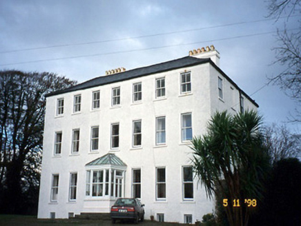 Tarbert HouseHouse · 910 yd
 Tarbert LighthouseLighthouse · 940 ydLabasheeda Fort (19th Century)Castle · 1.7 miTobertehHoly well · 1.8 mi
 Clonderalaw BayBay · 3.2 mi
 Glin CastleCastle · 3.5 mi
 St Senan's WellSpring · 3.5 mi
 Ballymacrinan BayBay · 3.5 miCrag WoodWood · 4.1 miMountshannon WoodWood · 4.4 mi
 Grave YardGraveyard · 4.7 miMountshannon EstateHeritage attraction · 5.3 mi
Pictures: National Inventory of Architectural Heritage; Charles W Glynn, Wikimedia Commons · CC BY-SA 2.0; P L Chadwick, Wikimedia Commons · CC BY-SA 2.0; Garry Dickinson, Wikimedia Commons · CC BY-SA 2.0; Tiger, Geograph · CC BY-SA 2.0; Graham Horn, Geograph · Creative Commons Attribution-ShareAlike 2.0
More archaeology and monuments in County Kerry · All of County Kerry
What do you know about this place?