What is recorded here
In 2000 archaeological testing by Richard O'Brien of a development c. 30m to the southwest of a levelled ringfort (TN041-062), revealed a large sub-soil cut ditch (Wth 3.7m) feature and a possible associated hearth feature (TN041-062001). The ditch was not investigated further and no finds were recovered. This testing was carried out under Licence No. 00E0892 (Bennett 2002, 325).
From the National Monuments Service (Archaeological Survey of Ireland) record TN041-062001
The monument record does not grant public access. Check the route and ask the landowner before entering private land.
- What survives
- Recorded monument
Places near here
Photo credits
- National Inventory of Architectural Heritage
- Mike Searle, Wikimedia Commons · CC BY-SA 2.0
- Mike Searle, Geograph · CC BY-SA 2.0
- Lár na Páirce Museum, Wikimedia Commons · CC BY 2.0
- Willow, Wikimedia Commons · CC BY 2.5
Ceremonial enclosure in BeakstownCeremonial enclosure · 110 ydConcentric enclosure in Beakstown,cormackstownConcentric enclosure · 912 yd Cabragh BridgeBridge · 1511 ydCormackstown Heritage CentreMuseum · 1620 ydGlengarriff HouseGates/railings/walls · 1.0 miBeakstown Saw MillMill (water) · 1.0 miBlack CastleCastle, tower house · 1.8 miBlack CastleCastle · 1.8 miLár na PáirceMuseum · 1.8 miEuropean ash2.0 miKillough Hill (site of)Mountain / peak · 3.8 miEuropean ash4.1 mi
 Cabragh BridgeBridge · 1511 ydCormackstown Heritage CentreMuseum · 1620 yd
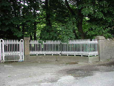 Glengarriff HouseGates/railings/walls · 1.0 mi
 Beakstown Saw MillMill (water) · 1.0 mi
 Black CastleCastle, tower house · 1.8 mi
 Black CastleCastle · 1.8 mi
 Lár na PáirceMuseum · 1.8 mi
 European ash2.0 miKillough Hill (site of)Mountain / peak · 3.8 miEuropean ash4.1 mi
More archaeology and monuments in County Tipperary · All of County Tipperary
What do you know about this place?