
What is recorded here
An abandoned multi-phase house. The core of the building is a two-storey structure, rectangular in plan, with a weatherslated bow end at SW. The entrance front (SE) is of five bays with a central door hidden behind a porch. The hipped roof is partially collapsed and there are two off-centre chimneys. Three two-storey gabled projections occupy the full length of the rear. There is a two-storey double gable-ended additon at NE with pigeon-holes in one gable. The remains of a farmyard with outbuildings lies adjacent to the NE and there is a walled garden to the NW. An abandoned gatelodge is c. 1km to the NE on the main Killarney-Killorglin road.
Compiled by: Elizabeth Byrne, Ursula Egan and Sheila Ronan, Archaeological Survey Unit, University College, Cork.
Date of upload: 31 January 2011
The monument record does not grant public access. Check the route and ask the landowner before entering private land.
- What survives
- Recorded monument
Places near here
 Castle (in Ruins)Castle, tower house · 497 yd
 European YewEuropean Yew · 565 yd
 Japanese pagoda treeJapanese pagoda tree · 579 yd
 IndicatedFairy fort / earthen ringfort · 960 yd
 CaveMan-made underground passage · 981 yd
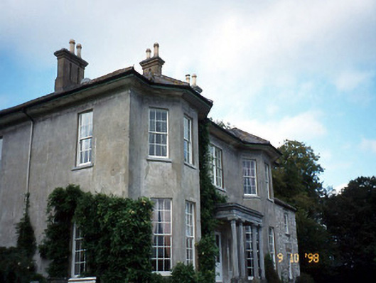 Beaufort Housecountry house · 999 yd
 CastleCastle, tower house · 1016 yd
 Dunloe Ogham StonesHeritage attraction · 1058 yd
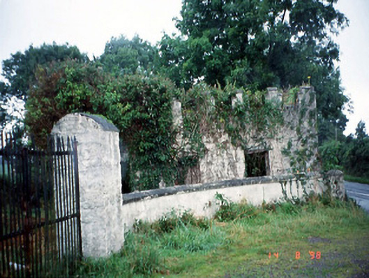 Grenagh Housegate lodge · 1165 yd
 Rabbit or Brown IslandIslet · 2.5 mi
 Tomies Mountain North TopMountain / peak · 2.5 mi
 O'Sullivan's CascadeWaterfall · 2.5 mi
Other information
Photo: Credit not shown in the picture search · Rights wording not checked; contact us if this picture should be removed