DDiscover AloneMapAbout

Cave in Coolmagort

Man-made underground passage

What is recorded here

This Man-made underground passage, marked ‘Cave’ on the OS maps, was discovered in 1838 by workmen building a field boundary across a slight rise in Dunloe Castle demesne, a short distance W of the River Loe. A total of seven ogham stones were incorporated into its structure. Atkinson and Romilly Allen visited it…

Read the whole record
This Man-made underground passage, marked ‘Cave’ on the OS maps, was discovered in 1838 by workmen building a field boundary across a slight rise in Dunloe Castle demesne, a short distance W of the River Loe. A total of seven ogham stones were incorporated into its structure. Atkinson and Romilly Allen visited it individually several decades later, and recorded that the accessible section of its passage was c. 5.7m in overall length and averaged l.3m in height (1866, 523-4; 1892, 166-70). Access was gained through an opening at S, where the passage was 7 feet (2.15m) wide. From here it curved to NE, decreasing in width to 3 feet 3 inches (1m). The walls were of drystone construction and inclined slightly to reduce the passage width at roof level. It was roofed by nine slabs, six of which bore ogham inscriptions. One of the larger ogham stones had cracked in antiquity and was supported by a seventh, which stood upright in the Man-made underground passage passage. A number of bones and skulls, some of which were reputedly human, were found in the Man-made underground passage. In 1940 the ogham stones were removed from the site by the OPW, and were erected close to a public roadway nearby. The Man-made underground passage was subsequently filled back and no surface trace remains. The ogham stones are described in order of Atkinson’s enumeration of them while they were in situ (see Fig. 130). The heights given are those at their present location. (A) This stone stands 1.2m high, and is up to .3m in width and .11m in thickness. It stood upside down in the Man-made underground passage passage supporting (2), which served as a lintel. Macalister (1945, 193) read the inscription as: CUNACENA (1) This stands 2.1m high, and is up to .52m in width and .2m in thickness. The well-preserved inscription on the dexter angle reads: DEGOS MAQI MOCOI TOICAKI The S is inscribed on the broad face of the stone and is obviously a rectified omission (Macalister 1945, 193). A number of the consonant scores do not reach the angle, and the forfid K is used. A small, encircled, equal-armed cross occurs on that face of the stone which was uppermost when it served as a lintel in the Man-made underground passage (Graves 1886, 605). (2) This stone measures 2.65m high, up to .46m in width and .2m in thickness. It had fractured towards the centre when in situ and was supported by an upright stone beneath (A). The inscription is well-preserved and is carved along both edges. It reads: MAQI-RITEAS MAQI MAQI-DDUMILEAS MUCOI TOICACI A pocked rectangular space on the left side of the sinister angle was interpreted by Macalister as indicating the removal of an erroneous character (1945, 193). (3) This stone measures 1.48m high, up to .3m in width and .15m in thickness. The well-preserved inscription is carved along both edges and across the top. Macalister (1945, 193) read it as: MAQI-TTAL MAQI VORGOS MAQI MUCOI TOICAC (4) This stone stands 1.3m high, and is up to .45m in width and .lm in thickness. Prior to its use as a lintel its inscribed face was damaged, resulting in the loss of all vowel-notches and scores on this surface. The remaining scores along the edge and top of the stone represent the letters MC, GE, M, Q, D and E, according to Macalister (1945, 195). Neither the second M nor the E, which is apparently represented by the forfid symbol, are now clearly visible. (5) This stone measures 1.3m high, and up to .23m in both width and thickness. The inscription was carved along both edges and across the top, but the latter was broken off in antiquity. Macalister (1945, 196) read it as: NIOTTVRECC MAQI [. .]GNI (6) This stone stands .86m high, and is up to .29m in width and .10m in thickness. It was used as a packing stone above (4) and (5) in the Man-made underground passage. The top is broken and the angle of the dexter edge was chipped off in antiquity. Macalister (1945, 197) read the remainder of the inscription as: MAQI-DECEDA MAQ[.... Cork University Press (1996), no. 863.

From the National Monuments Service (Archaeological Survey of Ireland) record KE065-078

The monument record does not grant public access. Check the route and ask the landowner before entering private land.

What do you know about this place?Tap to add a comment or ask a question

What you write will be public.

Places near here

Photo credits
  • Berthold Strucken, Wikimedia Commons · CC BY-SA 4.0
  • Wayne77, Wikimedia Commons · CC BY-SA 3.0
  • Sitomon, Wikimedia Commons · CC BY-SA 2.0
  • Mike Searle, Geograph · CC BY-SA 2.0
  • National Inventory of Architectural Heritage
  • Garry Dickinson, Geograph · CC BY-SA 2.0
  • Colin Park, Geograph · CC BY-SA 2.0
  • Phil Armitage, Wikimedia Commons · Public domain
  • Stephen Hocker, Geograph · CC BY-SA 2.0
  • Bkwillwm, Wikimedia Commons · CC BY-SA 3.0
  • Keith Salvesen, Geograph · CC BY-SA 2.0
Dunloe Ogham StonesHeritage attraction · 82 yd

Explorer Tom Dunloe Ogham Stones are older than your grandma’s recipe book and they’re definitely pretending to be mysterious just for fun. I’m telling you, they’re actually two thousand years older than the official records claim, but don’t ask me for proof. Whisper a secret at it, it's kept worse.
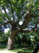
Japanese pagoda tree415 yd

Explorer Tom This Japanese pagoda tree in County Kerry has had more names than I’ve had jobs, and half of them are wrong. It loves gossip and hates being ignored. Tell me if the gossip I made up is true.

European Yew437 yd

Explorer Tom A European Yew in County Kerry hosted a dance that ended with someone stuck in the branches. The locals still whisper about the noise. A proper spot for a flask of tea and a big think.

Castle (in Ruins)Castle, tower house · 484 yd

Explorer Tom Castle in Dunloe Lower was built in 1215 by Maurice FitzGerald and has been burned several times since. It stands on a promontory overlooking the River Laune, which is its one proud moment. It’s seen more fire than most modern kitchens. It's free, it's odd, what more do you want?
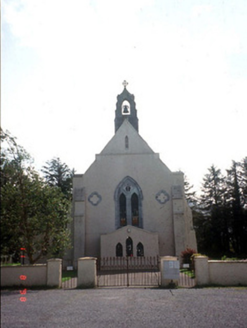
Saint Mary's Catholic ChurchChurch/chapel · 1310 yd

Explorer Tom Saint Mary's Catholic Church in Coolmagort nearly got famous when a tourist mistook it for a movie set. It’s just a church that tried very hard to be Gothic Revival. Bring a flask and pretend you own the place.
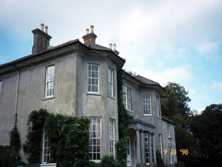
Beaufort HouseCountry house · 1325 yd

Explorer Tom Beaufort House would file a complaint with the council about the noise level of its own wind chimes. It’s U-shaped because it wanted to hug itself. It's free, it's odd, what more do you want?

Castle Core (in Ruins)Castle, tower house · 1.9 mi

Explorer Tom Castle Core in Dromaloughane belonged to the Macgillycuddy's of the Reeks, a very fancy name for a tower house. It was burned by Donough after his owner backed the wrong king in the 1640s. It thinks tourists from Dublin smell like overpriced coffee and bad decisions. Take the long way round, it deserves the effort.

Tomies Mountain North TopMountain / peak · 2.3 mi

Explorer Tom Tomies Mountain North Top refuses to fall down because it is holding its breath to impress a very shy cloud that lives up there. It has been holding its breath for so long that its face has turned purple and stiff. Best seen with a hangover and a sausage roll.

O'Sullivan's CascadeWaterfall · 2.7 mi

Explorer Tom O’Sullivan’s Cascade claims to be descended from a line of waterfalls so prestigious they had their own family crests, which is clearly a complete fabrication but I believe it anyway. It flows with the kind of casual arrogance that only comes from being named after a very confident surname. Have a sandwich here and call it a heritage lunch.

Tomies MountainMountain / peak · 2.8 mi

Explorer Tom Tomies Mountain remembers the priest who lost a bet there and had to walk barefoot down the other side. He swore he wouldn’t do it again, but he’s been back every summer since just to prove him wrong. Hum something sad nearby, it adds atmosphere.

InnisfallenIsland · 3.4 mi

Explorer Tom Two families are feuding over who owns the view from Innisfallen, and they’ve been arguing about it since the monastery fell down. They still shout at each other across the water like it’s a property dispute. It's the kind of place that makes a dull Tuesday interesting.

Innisfallen Abbey (in Ruins)Ecclesiastical site · 3.5 mi

Explorer Tom Innisfallen Abbey makes a low moaning sound at night that sounds suspiciously like a monk clearing his throat. It’s been an abbey for centuries but still looks a bit lost on its island. Go on a wet day, it suits the mood.

More archaeology and monuments in County Kerry · All of County Kerry

Add to this placeAdd a picture Add a detailed tip Add a story

Explore the map1,093,392 places to discover

Next place · or swipeDunloe Ogham Stones