What is recorded here
Tickell (JKAS 1960, 408) mentions reference to church or chapel in 'Moyacan' now Clonegall, in Royal Grant of 1627 to Sir Maurice Eustace. Down Survey records church (CW018-016001-) as 'ruined' in 1650. Present remains consist of central raised mound (H c. 3m) enclosed by fosse with external bank visible from W-N-NE, elsewhere modified by extension of graveyard. Nineteenth-century church now stands on mound. Cross base of socketed squared granite boulder. Quern stone found in graveyard in 1902 (JAPMD 1905, 192) and placed in present church. Earthwork is probably ringfort in origin although also resembles modified motte. Graveyard is depicted on the latest OS 6-inch map as a sub-rectangular enclosure (map dims. c. 56m N-S; c. 58m E-W).
Compiled by: Jean Farrelly
Date of upload: 19 August 2011
Medieval Christian burial ground, 17th century. Significance lies in its historical documentation through the Down Survey and association with early colonial land grants in the region.
The monument record does not grant public access. Check the route and ask the landowner before entering private land.
- What survives
- Recorded monument
Places near here
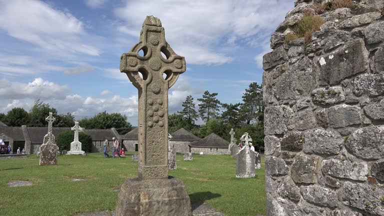 Cross in ClonegallCross · 1 yd
 Saint Fiacc's Church (Moyacomb)church/chapel · 21 yd
 Saint Brigid's Catholic Churchchurch/chapel · 399 yd
 Enclosure in ClonoganEnclosure · 766 yd
 Clonogan Castle (site of)Castle, unclassified · 781 yd
 Common LimeCommon Lime · 815 yd
 Huntington Castle & GardensHeritage attraction · 997 yd
 European YewEuropean Yew · 1026 yd
 Barragh Church (in ruins), GraveyardChurch · 1.9 mi
 Gibbet HillMountain / peak · 2.5 mi
 1798 rebellion Battle of Newtownbarry (AKA Bunclody) commemorative plaqueMemorial · 3.0 mi
 Bunclody 1798 Bicentenary MemorialMemorial · 3.0 mi