What is recorded here
Children’s graves, not adult graves, occupied this hidden Clare field. The boundary is almost gone, but the name still belongs to the smallest dead. That is the fact the land keeps.
Near the top of a gentle NW-facing slope in pasture. Hachured and named ‘Grave Yd. for Children' on the 1842 ed. of the OS 6-inch map. Marked with a cross and named ‘Children’s Burial Ground (Site of)’ on the 1897 OS 25-inch plan. Listed as ‘Burial ground’ in the RMP (1996). This barely traceable subcircular/subrectangular area (c. 42m N-S; 37m E-W) is defined by a slight external scarp (H 0.1-0.4m), except at the S where there is a scarp (H 0.3m) down into the enclosure. A NW-SE oriented field wall and hedge with mature bushes and trees runs through the middle of the interior. There are no visible grave markers.
Compiled by: Mary Tunney and Conn Herriott
Date of upload: 18 January 2023
The monument record does not grant public access. Check the route and ask the landowner before entering private land.
- What survives
- Recorded monument
Places near here
 Cloondooan Castle (in ruins)Castle, tower house · 468 yd
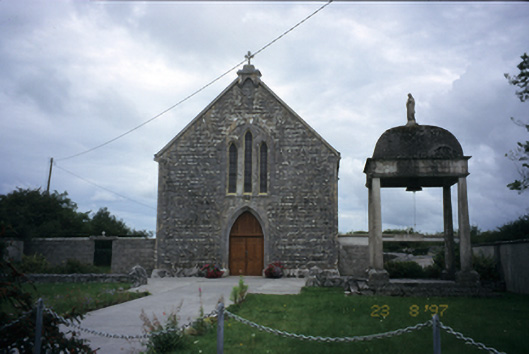 All Saints' Catholic Churchchurch/chapel · 1065 yd
 TobermacduaghHoly well · 1386 yd
 IndicatedEnclosure · 1.1 mi
 R.C. Chapel (in ruins)Church · 1.2 mi
 Bunnakippaun Castle (in ruins)Castle, unclassified · 1.2 mi
 Kilmacduagh MonasteryHeritage attraction · 1.7 mi
 Kilmacduagh Monastic SiteVisitor information · 1.8 mi
 Slieve RoeMountain / peak · 3.5 mi
 Mullagh MoreMountain / peak · 3.8 mi
 Kilnaloone GraveyardArchaeological place · 4.2 mi
 Coole-Garryland Nature ReserveNature reserve · 4.6 mi