What is recorded here
Embedded upright in the ground 1.3m E of the E gable of the medieval church of Baptistgrange (TS077-008001-). A tapering sandstone conglomerate graveslab (H above ground 1.12m; Wth at top 0.55m; Wth at base where visible 0.49m; T 0.23m) with small quartz inclusions. It faces W and is as described by Crawford (1912, 243), a 'slab 3ft. 3in. [c.1m] long, with an incised cross potent of three lines, in a single-line frame'. Maher (1997, 54) erroneously thought the slab was inverted, however, the head, though much worn, is visible as a three-armed potent cross. Within the incised rectangular terminal of each arm there is an inner rectangular depression. The cross-shaft consists of two incised lines. The cross base is buried below ground level. There are 4 deep horizontal score marks on the upper S side of the slab and 2-3 shallower ones. There is no visible inscription.
Compiled by: Jean Farrelly
Date of upload: 06 November 2013
The monument record does not grant public access. Check the route and ask the landowner before entering private land.
- What survives
- Recorded monument
Places near here
 Castle (in ruins)Castle, unclassified · 69 yd
 Site of Old VillageSettlement deserted, medieval · 93 yd
 CastleCastle, motte · 805 yd
 Enclosure in Shanbally (lisronagh Par.)Enclosure · 912 yd
 Catholic Church of Saint John the Baptistchurch/chapel · 1142 yd
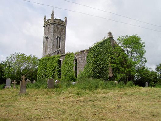 Lisronagh Churchchurch/chapel · 1245 yd
 Persian WalnutPersian Walnut · 1.0 mi
 Pedunculate OakPedunculate Oak · 1.1 mi
 East GateMemorial · 3.0 mi
 Kilknockan HillMountain / peak · 4.1 mi
 Charles BianconiMemorial · 4.8 mi
 Main GuardHeritage attraction · 4.8 mi